UN/LOCODE hub · Brazil
BRARA

Araucária

-25.5833°, -49.4000°
151,666
Population
2
Transport functions

Transport Functions

Rail
Road
UN/LOCODE

Hub Profile

Place type
Populated place
GeoNames
Region
Paraná
GeoNames
Population
151,666
GeoNames
Time zone
America/Sao_Paulo
GeoNames
Elevation
886 m
GeoNames

Location

Location of BRARA
Natural Earth 10m (public domain) · Paraná · BRARA · -25.58, -49.40GoogleOSMYandex

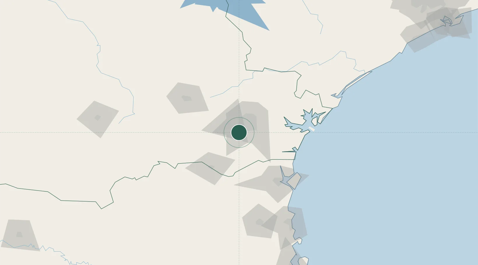
Nearby Logistics Neighbours

Cities
  1. 1Curitiba21 km
  2. 2Almirante Tamandaré33 km
  3. 3Rio Branco do Sul45 km
  4. 4Antonina73 km
  5. 5Paranaguá84 km
Nearest neighbours — logibook spatial index (haversine) over the source coordinates
Ports
  1. 1Paranagua89 km
  2. 2Sao Francisco107 km
  3. 3Itajai167 km
  4. 4Imbituba304 km
  5. 5Laguna330 km
Nearest neighbours — logibook spatial index (haversine) over the source coordinates
Airports
  1. 1Sikorski Heliport17 km
  2. 2Curitiba-Afonso Pena International Airport23 km
  3. 3Bacacheri Airport26 km
  4. 4Ponta Grossa Airport - Comandante Antonio Amilton Beraldo87 km
  5. 5Lauro Carneiro de Loyola Airport93 km
Nearest neighbours — logibook spatial index (haversine) over the source coordinates
Trade Zones
  1. 1ZPE de Imbituba (SC)241 km
  2. 2Zona Franca Puerto Iguazu Free Trade Zone518 km
  3. 3ZPE de Bataguassú (MS)530 km
  4. 4Zona Franca Internacional532 km
  5. 5Zona Franca Global533 km
Nearest neighbours — logibook spatial index (haversine) over the source coordinates
DatabookThe Record of Consolidated Knowledge
Brazil beyond logistics?
Browse databook

All Sources

LocationsUN/LOCODE
UN/LOCODE — free
LocationsGeoNames
CC BY 4.0
Portsthe NGA World Port Index
Public domain (US gov)
AirportsOurAirports
Public domain
Trade Zonesthe World Bank SEZ database
CC BY 4.0
Trade ZonesOpen Zone Map
CC BY
← Brazil locations