UN/LOCODE hub · Argentina
ARGOC

González Catán

-34.7667°, -58.6167°
1
Transport functions

Transport Functions

Multimodal
UN/LOCODE

Hub Profile

Place type
Populated place
GeoNames
Region
Buenos Aires
GeoNames
Time zone
America/Argentina/Buenos_Aires
GeoNames
Elevation
18 m
GeoNames

Location

Location of ARGOC
Natural Earth 10m (public domain) · Buenos Aires · ARGOC · -34.77, -58.62GoogleOSMYandex

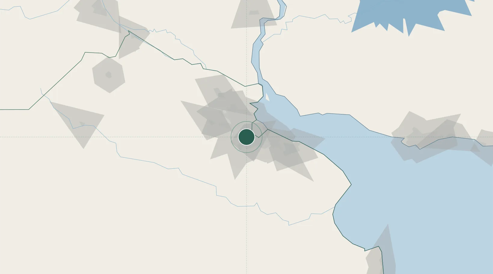
Nearby Logistics Neighbours

Cities
  1. 1Laferrere4 km
  2. 2San Justo13 km
  3. 3Canning14 km
  4. 4Mataderos15 km
  5. 5Caseros18 km
Nearest neighbours — logibook spatial index (haversine) over the source coordinates
Ports
  1. 1Buenos Aires29 km
  2. 2La Plata67 km
  3. 3Campana76 km
  4. 4Colonia78 km
  5. 5Zarate85 km
Nearest neighbours — logibook spatial index (haversine) over the source coordinates
Airports
  1. 1Ezeiza International Airport - Ministro Pistarini10 km
  2. 2El Palomar Airport17 km
  3. 3Aeroparque Jorge Newbery30 km
  4. 4San Fernando Airport35 km
  5. 5La Plata Airport70 km
Nearest neighbours — logibook spatial index (haversine) over the source coordinates
Trade Zones
  1. 1Zona Sur Buenos Aires17 km
  2. 2La Plata Free Trade Zone66 km
  3. 3Colonia Free Zone79 km
  4. 4Montes de Plata Free Zone79 km
  5. 5Nueva Palmira Free Zone100 km
Nearest neighbours — logibook spatial index (haversine) over the source coordinates
DatabookThe Record of Consolidated Knowledge
Argentina beyond logistics?
Browse databook

All Sources

LocationsUN/LOCODE
UN/LOCODE — free
Portsthe NGA World Port Index
Public domain (US gov)
AirportsOurAirports
Public domain
Trade Zonesthe World Bank SEZ database
CC BY 4.0
Trade ZonesOpen Zone Map
CC BY
← Argentina locations