Medium airport · Australia
Narrandera AirportYNAR
-34.7022°, 146.5120°
5,302 ft
Longest runway
2
Runways
474 ft
Elevation
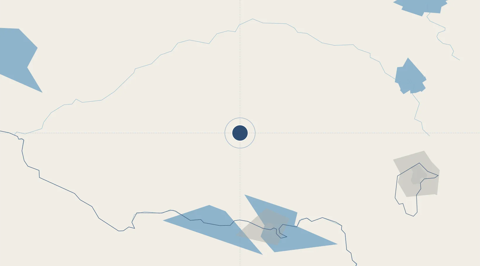
Runway & Layout

Radio Frequencies
CTAF
126.7 MHz
FSS
126 MHz
MELBOURNE CNTR
Navaids
NAR VOR-DME Narrandera 116.30 MHz
NAR NDB Narrandera 329 kHz
Runways · 2
| Runway | Dimensions | Surface | True heading | Lit |
|---|---|---|---|---|
| 14/32 | 5,302 × 98ft | Asphalt | 144° | ✓ |
| 05/23 | 3,346 × 98ft | Gravel | 053° | — |
Airport Specifications
IATA code
NRA
ICAO code
YNAR
Airport class
Medium airport
Scheduled service
Yes
Runway surface
Asphalt
Served city
Narrandera
Location
Nearby Logistics Neighbours
Airports
- 1Griffith Airport65 km
- 2Temora Airport97 km
- 3Wagga Wagga Airport101 km
- 4West Wyalong Airport106 km
- 5Cootamundra Airport140 km
Cities
- 1Leeton19 km
- 2Grong Grong25 km
- 3Whitton37 km
- 4Matong38 km
- 5Barellan45 km
Ports
- 1Batemans Bay350 km
- 2Melbourne375 km
- 3Jervis Bay394 km
- 4Port Kembla404 km
- 5Eden404 km
Trade Zones
DatabookThe Record of Consolidated Knowledge
Australia beyond logistics?