Specialized Zone · Azerbaijan

Garadagh Industrial Park Active
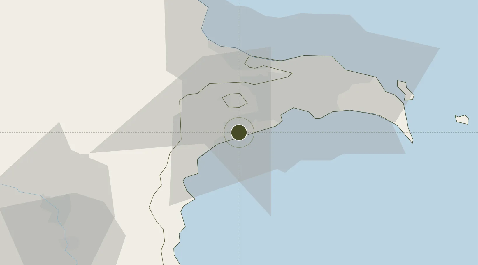
40.2655°, 49.6664°
72 ha
Zone area
690.3 km
Nearest port
36.6 km
Nearest airport

Gateway access

Nearest neighbours — logibook spatial index (haversine) over the source coordinates

Zone profile

Zone type
Specialized Zone
Open Zone Map
Specialization
Manufacturing
Open Zone Map
Region
Bakı
Open Zone Map
Status
Active
Open Zone Map
Management
Public-Private Partnership
Open Zone Map
Operator
Sumgait Chemical Industrial Park, LLC.
Open Zone Map
Legal framework
Presidential Decree No. 1255 dated June 3, 2015
Open Zone Map

Location

Location of ozm-69
Natural Earth 10m (public domain) · Bakı · ozm-69 · 40.27, 49.67GoogleOSMYandex

Nearby Logistics Neighbours

Ports
  1. 1Batumi690 km
  2. 2Supsa Marine Terminal696 km
  3. 3Hopa707 km
  4. 4Rize777 km
  5. 5Sokhumi782 km
Nearest neighbours — logibook spatial index (haversine) over the source coordinates
Airports
  1. 1Zabrat Airport37 km
  2. 2Nasosnaya Air Base37 km
  3. 3Heydar Aliyev International Airport40 km
  4. 4Baku Kala Air Base48 km
  5. 5Sitalchay Airbase63 km
Nearest neighbours — logibook spatial index (haversine) over the source coordinates
Cities
  1. 1Qaradag6 km
  2. 2Sangachal17 km
  3. 3Sumqayit35 km
  4. 4Alat42 km
  5. 5Shirvan75 km
Nearest neighbours — logibook spatial index (haversine) over the source coordinates
Trade Zones
  1. 1ANAS High Technologies Park26 km
  2. 2Alat Free Economic Zone26 km
  3. 3Balakhani Industrial Park30 km
  4. 4Sumgayit Chemical Industrial Park37 km
  5. 5Pirallahi Industrial Park61 km
Nearest neighbours — logibook spatial index (haversine) over the source coordinates
DatabookThe Record of Consolidated Knowledge
Azerbaijan beyond logistics?
Browse databook

All Sources

Trade ZonesOpen Zone Map
CC BY
Portsthe NGA World Port Index
Public domain (US gov)
AirportsOurAirports
Public domain
LocationsUN/LOCODE
UN/LOCODE — free
← Azerbaijan trade zones