Diversified Zone · China

Qingdao Huanhai Economic Development Zone Active
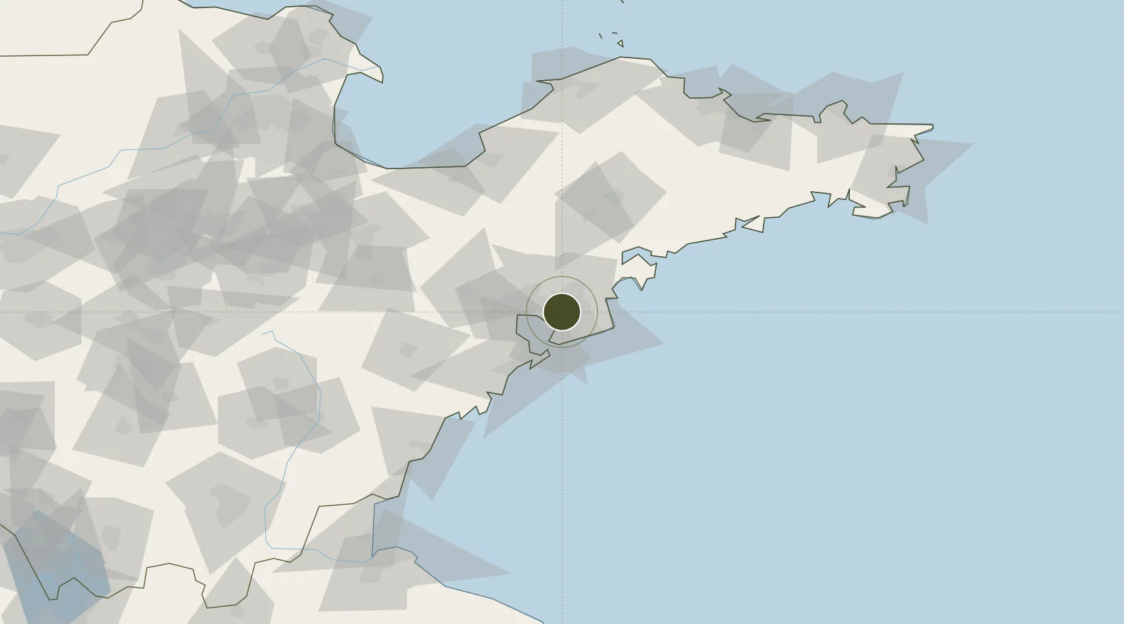
36.2448°, 120.3748°
463 ha
Zone area
25.4 km
Nearest port
28.8 km
Nearest airport

Gateway access

Nearest neighbours — logibook spatial index (haversine) over the source coordinates

Zone profile

Zone type
Diversified Zone
Open Zone Map
Region
Shandong
Open Zone Map
Status
Active
Open Zone Map
Management
Public
Open Zone Map
Operator
Management committee
Open Zone Map
Legal framework
In June 1992, shandong Provincial people's government approved the establishment of the development zone
Open Zone Map

Location

Location of ozm-511
Natural Earth 10m (public domain) · Shandong · ozm-511 · 36.24, 120.37GoogleOSMYandex

Nearby Logistics Neighbours

Ports
  1. 1Qingdao Gang25 km
  2. 2Rizhao120 km
  3. 3Longkou Gang155 km
  4. 4Lanshan158 km
  5. 5Yantai174 km
Nearest neighbours — logibook spatial index (haversine) over the source coordinates
Airports
  1. 1Qingdao Jiaodong International Airport29 km
  2. 2Jiaozhou Jiaocheng Air Base33 km
  3. 3Laiyang Air Base82 km
  4. 4Zhucheng Air Base88 km
  5. 5Weifang Nanyuan Airport121 km
Nearest neighbours — logibook spatial index (haversine) over the source coordinates
Cities
  1. 1Qianwan26 km
  2. 2Qingdao27 km
  3. 3Aoshanwei29 km
  4. 4Xianlang30 km
  5. 5Jiaozhou37 km
Nearest neighbours — logibook spatial index (haversine) over the source coordinates
Trade Zones
  1. 1Qingdao Chengyang Industrial Park15 km
  2. 2Jimo Economic Development Zone24 km
  3. 3Qingdao Export Processing Zone32 km
  4. 4Qingdao National Economic and Technological Development Zone34 km
  5. 5Gaomi Economic Development Zone54 km
Nearest neighbours — logibook spatial index (haversine) over the source coordinates
DatabookThe Record of Consolidated Knowledge
China beyond logistics?
Browse databook

All Sources

Trade ZonesOpen Zone Map
CC BY
Portsthe NGA World Port Index
Public domain (US gov)
AirportsOurAirports
Public domain
LocationsUN/LOCODE
UN/LOCODE — free
← China trade zones