Free Trade Zone · Syria

Aleppo Free Zone Active
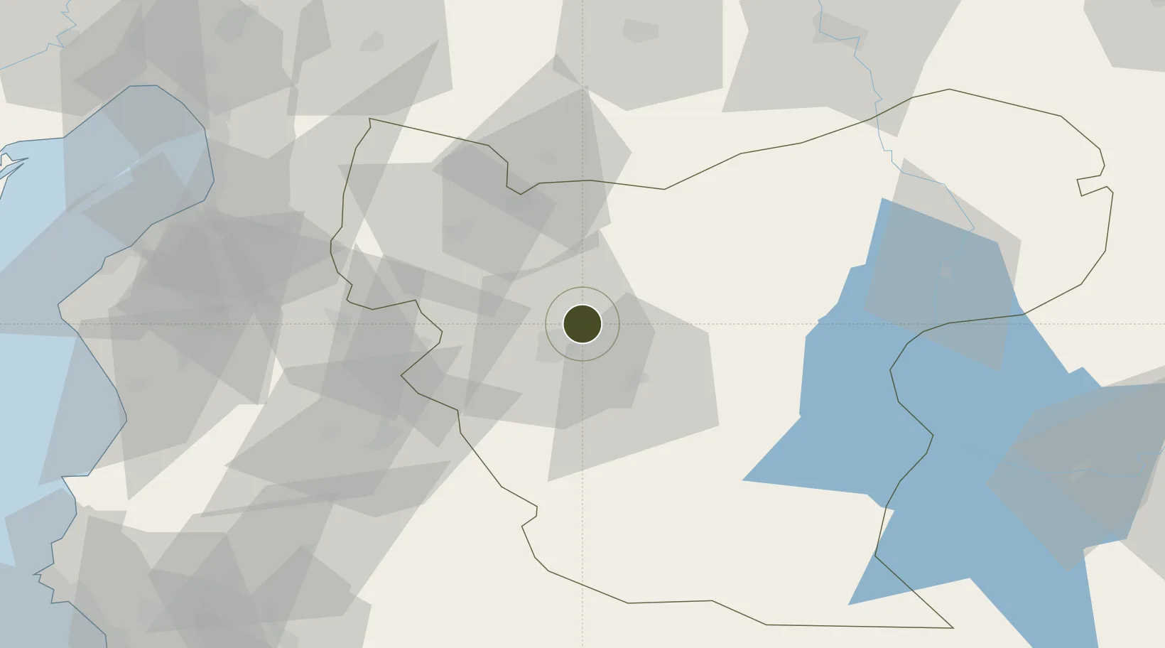
36.2665°, 37.2219°
3,309 ha
Zone area
101.4 km
Nearest port
9.5 km
Nearest airport

Gateway access

Nearest neighbours — logibook spatial index (haversine) over the source coordinates

Zone profile

Zone type
Free Trade Zone
Open Zone Map
Region
Aleppo
Open Zone Map
Status
Active
Open Zone Map
Management
Public
Open Zone Map
Operator
The General Establishment of Free Zones
Open Zone Map
Legal framework
Investment Law No. 10 (1991) and Its Amending Decrees No. 7 (2000) and Nos. 8 and 9 on January 27, 2007.
Open Zone Map

Location

Location of ozm-4380
Natural Earth 10m (public domain) · Aleppo · ozm-4380 · 36.27, 37.22GoogleOSMYandex

Nearby Logistics Neighbours

Ports
  1. 1Iskenderun101 km
  2. 2Yakacik106 km
  3. 3Toros Gubre133 km
  4. 4Botas134 km
  5. 5Al Ladhiqiyah154 km
Nearest neighbours — logibook spatial index (haversine) over the source coordinates
Airports
  1. 1Aleppo International Airport10 km
  2. 2Abu ad Duhur Air Base60 km
  3. 3Gaziantep Oğuzeli International Airport79 km
  4. 4Hatay Airport85 km
  5. 5Kahramanmaraş Airport144 km
Nearest neighbours — logibook spatial index (haversine) over the source coordinates
Cities
  1. 1Kuyubasi92 km
  2. 2Nizip96 km
  3. 3Harbiye99 km
  4. 4Iskenderun100 km
  5. 5Sariseki100 km
Nearest neighbours — logibook spatial index (haversine) over the source coordinates
Trade Zones
  1. 1Gaziantep Free Zone93 km
  2. 2Iskenderun Organized Industrial Zone102 km
  3. 3Osmaniye Organized Industrial Zone130 km
  4. 4Adana Yumurtalik Free Zone130 km
  5. 5LatakiaLattakia Free Zone148 km
Nearest neighbours — logibook spatial index (haversine) over the source coordinates
DatabookThe Record of Consolidated Knowledge
Syria beyond logistics?
Browse databook

All Sources

Trade ZonesOpen Zone Map
CC BY
Portsthe NGA World Port Index
Public domain (US gov)
AirportsOurAirports
Public domain
LocationsUN/LOCODE
UN/LOCODE — free
← Syria trade zones