UN/LOCODE hub · Türkiye
TRSRS

Sariseki

36.6667°, 36.2167°
3
Transport functions

Transport Functions

Port
Rail
Road
UN/LOCODE

Hub Profile

Place type
Populated place
GeoNames
Region
Hatay
GeoNames
Time zone
Europe/Istanbul
GeoNames
Elevation
8 m
GeoNames

Location

Location of TRSRS
Natural Earth 10m (public domain) · Hatay · TRSRS · 36.67, 36.22GoogleOSMYandex

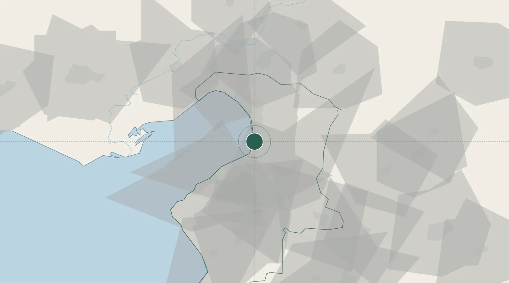
Nearby Logistics Neighbours

Cities
  1. 1Iskenderun5 km
  2. 2Isdemir6 km
  3. 3Botas17 km
  4. 4Dörtyol22 km
  5. 5Toros Gubre Terminal, Gubre35 km
Nearest neighbours — logibook spatial index (haversine) over the source coordinates
Ports
  1. 1Yakacik6 km
  2. 2Iskenderun9 km
  3. 3Botas35 km
  4. 4Toros Gubre36 km
  5. 5Al Ladhiqiyah132 km
Nearest neighbours — logibook spatial index (haversine) over the source coordinates
Airports
  1. 1Hatay Airport34 km
  2. 2İncirlik Air Base80 km
  3. 3Adana Şakirpaşa Airport90 km
  4. 4Çukurova International Airport105 km
  5. 5Aleppo International Airport105 km
Nearest neighbours — logibook spatial index (haversine) over the source coordinates
Trade Zones
  1. 1Iskenderun Organized Industrial Zone3 km
  2. 2Adana Yumurtalik Free Zone34 km
  3. 3Osmaniye Organized Industrial Zone40 km
  4. 4Adana Haci Sabanci Organized Industrial Zone65 km
  5. 5Aleppo Free Zone100 km
Nearest neighbours — logibook spatial index (haversine) over the source coordinates
DatabookThe Record of Consolidated Knowledge
Türkiye beyond logistics?
Browse databook

All Sources

LocationsUN/LOCODE
UN/LOCODE — free
Portsthe NGA World Port Index
Public domain (US gov)
AirportsOurAirports
Public domain
Trade Zonesthe World Bank SEZ database
CC BY 4.0
Trade ZonesOpen Zone Map
CC BY
← Türkiye locations