Export Processing Zone · North Korea

Kyongwon Economic Development Zone Active
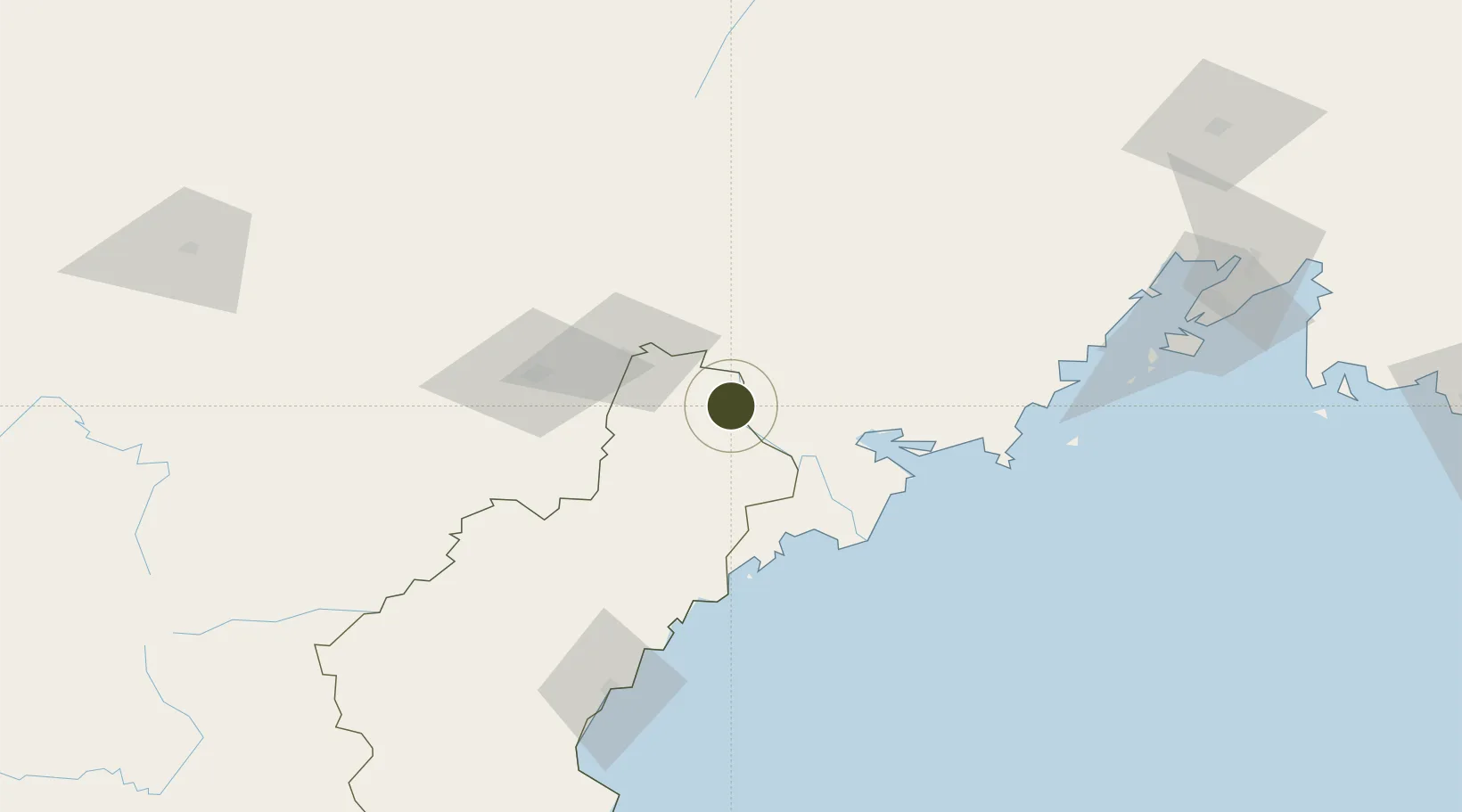
42.7816°, 130.2097°
100 ha
Zone area
50.4 km
Nearest port
62.9 km
Nearest airport

Gateway access

Nearest neighbours — logibook spatial index (haversine) over the source coordinates

Zone profile

Zone type
Export Processing Zone
Open Zone Map
Region
Hamgyŏng-bukto
Open Zone Map
Status
Active
Open Zone Map
Management
Public
Open Zone Map
Operator
Ministry of External Economic Relations
Open Zone Map
Legal framework
Labour Regulations for Foreign-Funded Enterprises in FETZ (Adopted as decision NO.8 of the Administration Council of the DPRK dated on December 3, 1993) The Law of the Democratic People’s Republic of Korea on the Rason Economic and Trade Zone; North Korea
Open Zone Map

Location

Location of ozm-2990
Natural Earth 10m (public domain) · Hamgyŏng-bukto · ozm-2990 · 42.78, 130.21GoogleOSMYandex

Nearby Logistics Neighbours

Ports
  1. 1Pos'yet50 km
  2. 2Najin61 km
  3. 3Zarubino73 km
  4. 4Slavyanka96 km
  5. 5Ch'ongjin117 km
Nearest neighbours — logibook spatial index (haversine) over the source coordinates
Airports
  1. 1Yanji Chaoyangchuan Airport63 km
  2. 2Orang (Chongjin) Airport157 km
  3. 3Vladivostok International Airport172 km
  4. 4Vozdvizhenka Air Base187 km
  5. 5Mudanjiang Hailang International Airport201 km
Nearest neighbours — logibook spatial index (haversine) over the source coordinates
Cities
  1. 1Hunchun16 km
  2. 2Yueqing34 km
  3. 3Tumen35 km
  4. 4Rajin (Najin)63 km
  5. 5Zarubino74 km
Nearest neighbours — logibook spatial index (haversine) over the source coordinates
DatabookThe Record of Consolidated Knowledge
North Korea beyond logistics?
Browse databook

All Sources

Trade ZonesOpen Zone Map
CC BY
Portsthe NGA World Port Index
Public domain (US gov)
AirportsOurAirports
Public domain
LocationsUN/LOCODE
UN/LOCODE — free
← North Korea trade zones