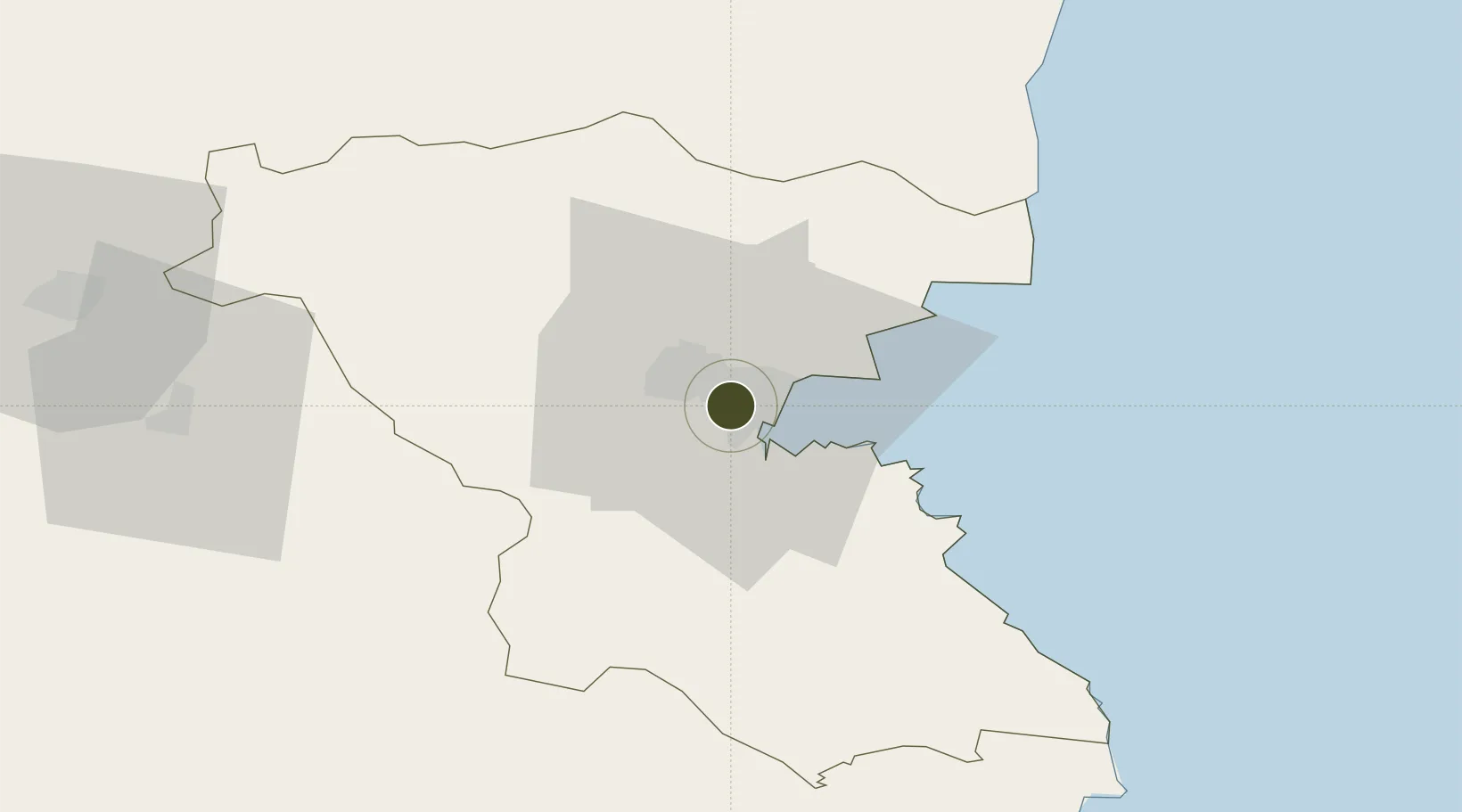
Export Processing Zone · Bulgaria

Bourgas Free Economic Zone Active

42.5158°, 27.4104°
15 ha
Zone area
7.0 km
Nearest port
10.5 km
Nearest airport

Gateway access

Nearest neighbours — logibook spatial index (haversine) over the source coordinates

Zone profile

Zone type
Export Processing Zone
Open Zone Map
Region
Burgas
Open Zone Map
Status
Active
Open Zone Map
Management
Public-Private Partnership
Open Zone Map
Operator
Bourgas Free Zone JSC
Open Zone Map
Legal framework
Government decree No. 2242 /1989, Regulation decree No. 24/31.05.1989 Regulation (EU) No. 952/2013 of the European Parliament and of the Council of 9 October 2013 laying down the Union Customs Code (recast)
Open Zone Map

Location

Location of ozm-239
Natural Earth 10m (public domain) · Burgas · ozm-239 · 42.52, 27.41GoogleOSMYandex

Nearby Logistics Neighbours

Ports
  1. 1Burgas7 km
  2. 2Varna87 km
  3. 3Tekirdag171 km
  4. 4Mangalia173 km
  5. 5Basarabi201 km
Nearest neighbours — logibook spatial index (haversine) over the source coordinates
Airports
  1. 1Burgas Airport11 km
  2. 2Varna Airport87 km
  3. 3Bezmer Air Base87 km
  4. 4Balchik Airfield119 km
  5. 5Gorna Oryahovitsa Airport155 km
Nearest neighbours — logibook spatial index (haversine) over the source coordinates
Cities
  1. 1Burgas6 km
  2. 2Debelt18 km
  3. 3Bata25 km
  4. 4Aitos26 km
  5. 5Sozopol26 km
Nearest neighbours — logibook spatial index (haversine) over the source coordinates
Trade Zones
  1. 1Kirklareli Organized Industrial Zone92 km
  2. 2Svilengrad Free Economic Zone131 km
  3. 3European Free Zone142 km
  4. 4Cerkezkoy Organized Industrial Zone143 km
  5. 5Istanbul Tracia Free Zone178 km
Nearest neighbours — logibook spatial index (haversine) over the source coordinates
DatabookThe Record of Consolidated Knowledge
Bulgaria beyond logistics?
Browse databook

All Sources

Trade ZonesOpen Zone Map
CC BY
Portsthe NGA World Port Index
Public domain (US gov)
AirportsOurAirports
Public domain
LocationsUN/LOCODE
UN/LOCODE — free
← Bulgaria trade zones