Specialized Zone · India

Euro Multivision Pvt. Ltd. Active
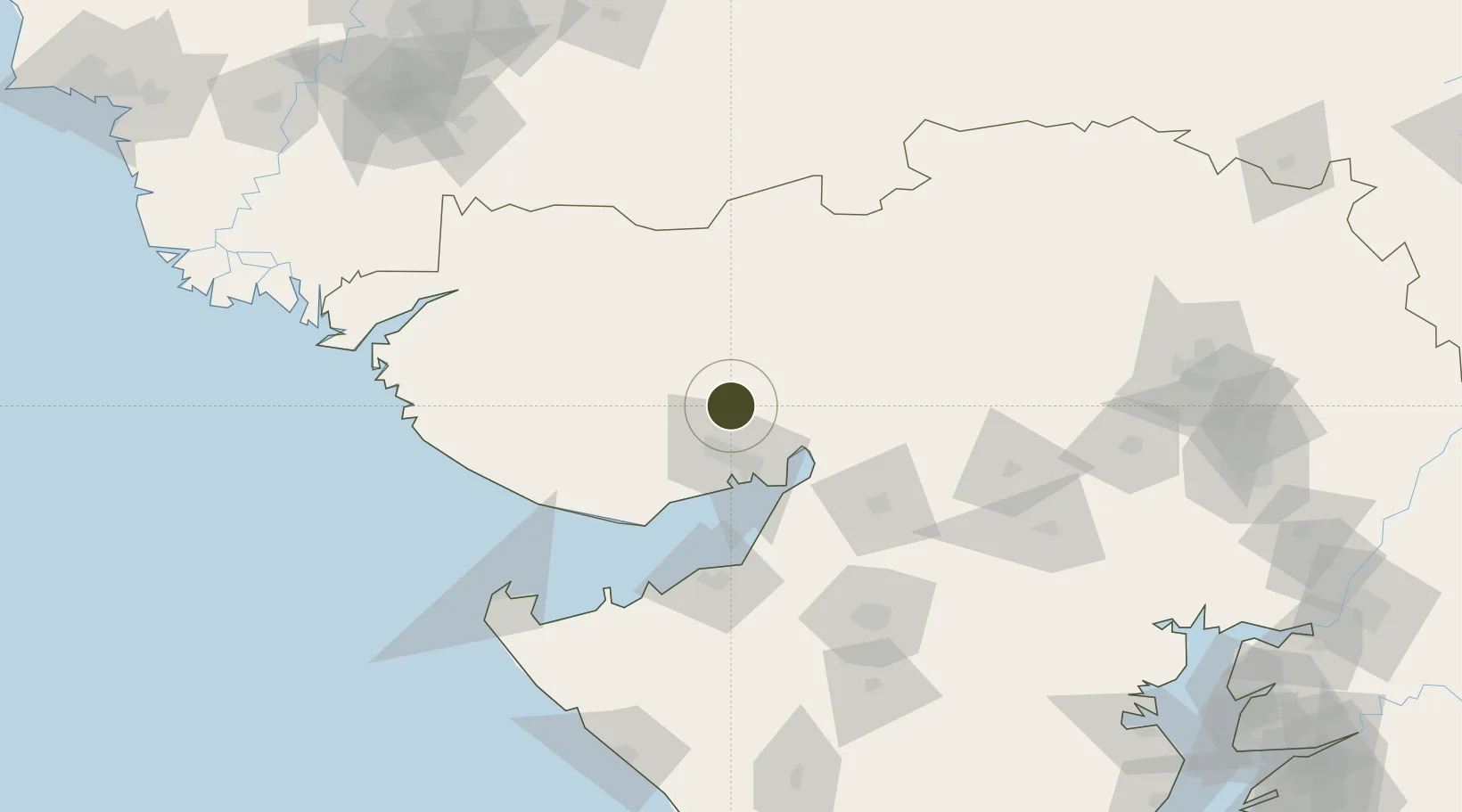
23.3218°, 70.1272°
12 ha
Zone area
33.4 km
Nearest port
23.4 km
Nearest airport

Gateway access

Nearest neighbours — logibook spatial index (haversine) over the source coordinates

Zone profile

Zone type
Specialized Zone
Open Zone Map
Specialization
Energy
Open Zone Map
Region
Gujarat
Open Zone Map
Status
Active
Open Zone Map
Management
Private
Open Zone Map
Operator
Euro Multivision Ltd.
Open Zone Map
Legal framework
Gujarat Special Economic Zone ACT, 2004., The Special Economic Zones Act, 2005
Open Zone Map

Location

Location of ozm-2185
Natural Earth 10m (public domain) · Gujarat · ozm-2185 · 23.32, 70.13GoogleOSMYandex

Nearby Logistics Neighbours

Ports
  1. 1Kandla33 km
  2. 2Navlakhi52 km
  3. 3Mundra79 km
  4. 4Bedi84 km
  5. 5Mandvi96 km
Nearest neighbours — logibook spatial index (haversine) over the source coordinates
Airports
  1. 1Kandla Airport23 km
  2. 2Bhuj Airport47 km
  3. 3Jamnagar Airport96 km
  4. 4Rajkot Airport131 km
  5. 5Rajkot International Airport141 km
Nearest neighbours — logibook spatial index (haversine) over the source coordinates
Cities
  1. 1Welspun Anjar-SEZ/Anjar24 km
  2. 2OPGS SEZ/Gandhidham27 km
  3. 3Gandhidham27 km
  4. 4Kandla-SEZ/Gandhidham31 km
  5. 5Kandla32 km
Nearest neighbours — logibook spatial index (haversine) over the source coordinates
Trade Zones
  1. 1Kandla Special Economic Zone32 km
  2. 2Kandla Special Economic Zone32 km
  3. 3Ganesh Infrastructure Pvt. Ltd.68 km
  4. 4Adani Mundra Port78 km
  5. 5Reliance Jamnagar Infrastructure Ltd.94 km
Nearest neighbours — logibook spatial index (haversine) over the source coordinates
DatabookThe Record of Consolidated Knowledge
India beyond logistics?
Browse databook

All Sources

Trade ZonesOpen Zone Map
CC BY
Portsthe NGA World Port Index
Public domain (US gov)
AirportsOurAirports
Public domain
LocationsUN/LOCODE
UN/LOCODE — free
← India trade zones