Export Processing Zone · China

Longkou High-tech Industrial Park Active
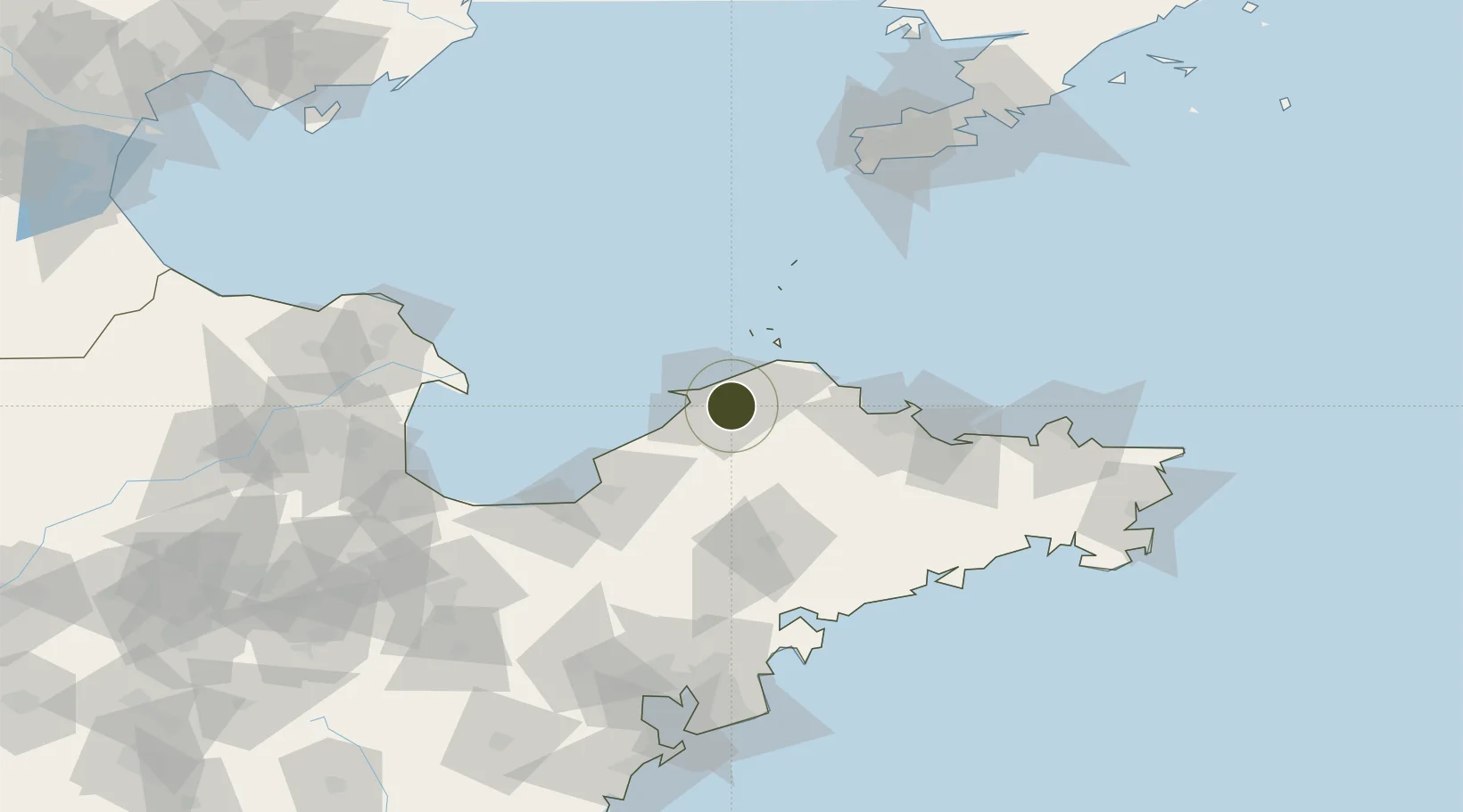
37.6144°, 120.5200°
231 ha
Zone area
20.9 km
Nearest port
40.7 km
Nearest airport

Gateway access

Nearest neighbours — logibook spatial index (haversine) over the source coordinates

Zone profile

Zone type
Export Processing Zone
Open Zone Map
Region
Shandong
Open Zone Map
Status
Active
Open Zone Map
Management
Public
Open Zone Map
Operator
Working Committee of Longkou High-tech Industrial Park
Open Zone Map
Legal framework
Shiliang Town, Longkou CityRegulatory detailed planning revision publicity
Open Zone Map

Location

Location of ozm-1072
Natural Earth 10m (public domain) · Shandong · ozm-1072 · 37.61, 120.52GoogleOSMYandex

Nearby Logistics Neighbours

Ports
  1. 1Longkou Gang21 km
  2. 2Penglai36 km
  3. 3Yantai82 km
  4. 4Weihai140 km
  5. 5Lushun145 km
Nearest neighbours — logibook spatial index (haversine) over the source coordinates
Airports
  1. 1Yantai Penglai International Airport41 km
  2. 2Laiyang Air Base73 km
  3. 3Qingdao Jiaodong International Airport145 km
  4. 4Jiaozhou Jiaocheng Air Base149 km
  5. 5Dongying Shengli Airport153 km
Nearest neighbours — logibook spatial index (haversine) over the source coordinates
Cities
  1. 1Longkou Pt22 km
  2. 2Penglai Pt29 km
  3. 3Laizhou Pt71 km
  4. 4Taipingwan72 km
  5. 5Yantai76 km
Nearest neighbours — logibook spatial index (haversine) over the source coordinates
Trade Zones
  1. 1Longkou Economic Development Zone17 km
  2. 2Zhaoyuan Industrial Park26 km
  3. 3Qixia Economic Development Zone49 km
  4. 4Laizhou Economic Development Zone66 km
  5. 5Laiyang Economic Development Zone74 km
Nearest neighbours — logibook spatial index (haversine) over the source coordinates
DatabookThe Record of Consolidated Knowledge
China beyond logistics?
Browse databook

All Sources

Trade ZonesOpen Zone Map
CC BY
Portsthe NGA World Port Index
Public domain (US gov)
AirportsOurAirports
Public domain
LocationsUN/LOCODE
UN/LOCODE — free
← China trade zones