Diversified Zone · China

Longkou Economic Development Zone Active
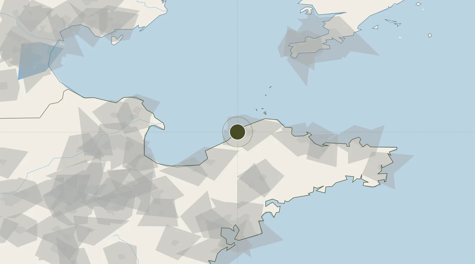
37.6389°, 120.3350°
6,720 ha
Zone area
4.6 km
Nearest port
56.7 km
Nearest airport

Gateway access

Nearest neighbours — logibook spatial index (haversine) over the source coordinates

Zone profile

Zone type
Diversified Zone
Open Zone Map
Region
Shandong
Open Zone Map
Status
Active
Open Zone Map
Management
Public
Open Zone Map
Operator
Management committee
Open Zone Map
Legal framework
It was approved by Shandong Provincial people's Government in 1992
Open Zone Map

Location

Location of ozm-969
Natural Earth 10m (public domain) · Shandong · ozm-969 · 37.64, 120.33GoogleOSMYandex

Nearby Logistics Neighbours

Ports
  1. 1Longkou Gang5 km
  2. 2Penglai48 km
  3. 3Yantai99 km
  4. 4Lushun150 km
  5. 5Weihai156 km
Nearest neighbours — logibook spatial index (haversine) over the source coordinates
Airports
  1. 1Yantai Penglai International Airport57 km
  2. 2Laiyang Air Base78 km
  3. 3Dongying Shengli Airport137 km
  4. 4Qingdao Jiaodong International Airport144 km
  5. 5Jiaozhou Jiaocheng Air Base148 km
Nearest neighbours — logibook spatial index (haversine) over the source coordinates
Cities
  1. 1Longkou Pt6 km
  2. 2Penglai Pt41 km
  3. 3Taipingwan61 km
  4. 4Laizhou Pt63 km
  5. 5Laiyang89 km
Nearest neighbours — logibook spatial index (haversine) over the source coordinates
Trade Zones
  1. 1Longkou High-tech Industrial Park17 km
  2. 2Zhaoyuan Industrial Park29 km
  3. 3Laizhou Economic Development Zone56 km
  4. 4Qixia Economic Development Zone65 km
  5. 5Laiyang Economic Development Zone81 km
Nearest neighbours — logibook spatial index (haversine) over the source coordinates
DatabookThe Record of Consolidated Knowledge
China beyond logistics?
Browse databook

All Sources

Trade ZonesOpen Zone Map
CC BY
Portsthe NGA World Port Index
Public domain (US gov)
AirportsOurAirports
Public domain
LocationsUN/LOCODE
UN/LOCODE — free
← China trade zones