Industrial Estate · Guyana

Ruimveldt Industrial Estate Active
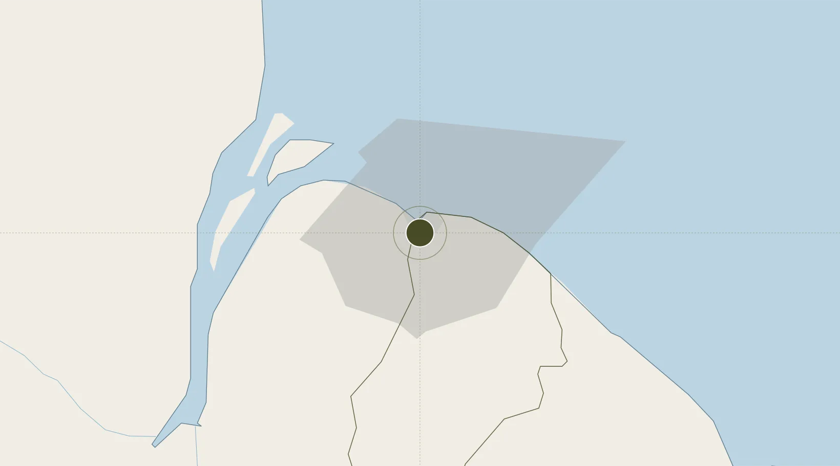
6.7918°, -58.1670°
13 ha
Zone area
4.6 km
Nearest port
6.9 km
Nearest airport

Gateway access

Nearest neighbours — logibook spatial index (haversine) over the source coordinates

Zone profile

Zone type
Industrial Estate
the World Bank SEZ database
Region
East Berbice-Corentyne
the World Bank SEZ database
Status
Active
the World Bank SEZ database
Established
1960
the World Bank SEZ database
Management
State-owned enterprise
the World Bank SEZ database
Operator
National Industry and Commercial Investment Ltd
the World Bank SEZ database
Regulatory authority
Ministry of Industry, Tourism, and Commerce
the World Bank SEZ database
Legal framework
No active legal framework
the World Bank SEZ database

Location

Location of GUY3
Natural Earth 10m (public domain) · East Berbice-Corentyne · GUY3 · 6.79, -58.17GoogleOSMYandex

Fiscal & incentives

Corporate tax
40%
the World Bank SEZ database
Tax relief
No exemption
the World Bank SEZ database
Relief duration
No exemption
the World Bank SEZ database
VAT
No exemption
the World Bank SEZ database
Import duty (inputs)
No exemption
the World Bank SEZ database
Import duty (capex)
No exemption
the World Bank SEZ database
Profit repatriation
No exemption
the World Bank SEZ database
Capital gains
No exemption
the World Bank SEZ database
Withholding tax
No exemption
the World Bank SEZ database
Min. investment
None
the World Bank SEZ database
Min. export
0%
the World Bank SEZ database
Employment incentive
No exemption
the World Bank SEZ database
Developer incentive
No active legal framework
the World Bank SEZ database

Nearby Logistics Neighbours

Ports
  1. 1Georgetown5 km
  2. 2Linden89 km
  3. 3New Amsterdam94 km
  4. 4Nieuw Nickerie159 km
  5. 5Paramaribo348 km
Nearest neighbours — logibook spatial index (haversine) over the source coordinates
Airports
  1. 1Eugene F. Correia International Airport7 km
  2. 2Cheddi Jagan International Airport34 km
  3. 3Wageningen Airstrip196 km
  4. 4Kaieteur Airport232 km
  5. 5Eduard Alexander Gummels Airport345 km
Nearest neighbours — logibook spatial index (haversine) over the source coordinates
Cities
  1. 1Georgetown1 km
  2. 2Everton23 km
  3. 3Agricola Village36 km
  4. 4Adventure48 km
  5. 5Linden89 km
Nearest neighbours — logibook spatial index (haversine) over the source coordinates
Trade Zones
  1. 1Eccles Industrial Estate2 km
  2. 2Coldingen Industrial Estate17 km
  3. 3Free Port of Santa Elena de Uairén407 km
  4. 4Lethem Industrial Estate420 km
  5. 5Moruga Agro-Processing and Light Industrial Park511 km
Nearest neighbours — logibook spatial index (haversine) over the source coordinates
DatabookThe Record of Consolidated Knowledge
Guyana beyond logistics?
Browse databook

All Sources

Trade Zonesthe World Bank SEZ database
CC BY 4.0
Portsthe NGA World Port Index
Public domain (US gov)
AirportsOurAirports
Public domain
LocationsUN/LOCODE
UN/LOCODE — free
← Guyana trade zones