UN/LOCODE hub · Vietnam
VNTBM

Tan Binh

10.8000°, 106.6500°
89,373
Population
1
Transport functions

Transport Functions

Multimodal
UN/LOCODE

Hub Profile

Place type
Urban district
GeoNames
Region
Ho Chi Minh City (HCMC)
GeoNames
Population
89,373
GeoNames
Time zone
Asia/Ho_Chi_Minh
GeoNames
Elevation
12 m
GeoNames

Location

Location of VNTBM
Natural Earth 10m (public domain) · Ho Chi Minh City (HCMC) · VNTBM · 10.80, 106.65GoogleOSMYandex

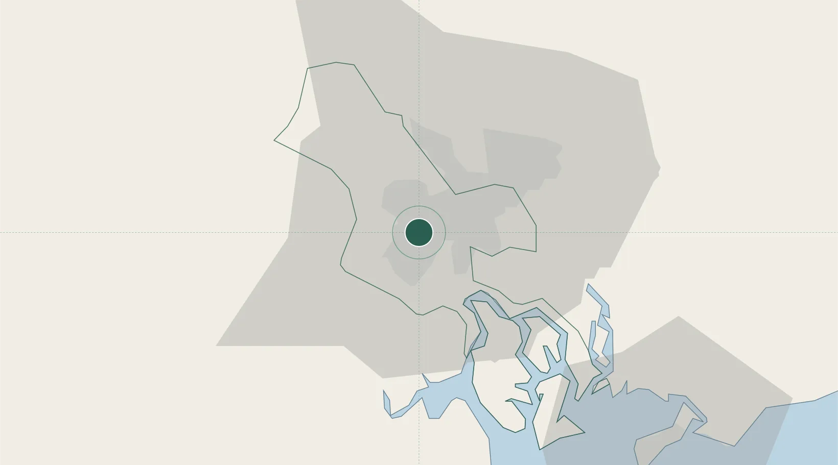
Nearby Logistics Neighbours

Cities
  1. 1Phú Nhuan3 km
  2. 2Song Than ICD8 km
  3. 3Tân Thuan Dông10 km
  4. 4Bèn Nghè11 km
  5. 5ICD Sotrans11 km
Nearest neighbours — logibook spatial index (haversine) over the source coordinates
Ports
  1. 1Thanh Ho Chi Minh8 km
  2. 2Thanh Hoa13 km
  3. 3Cat Lai16 km
  4. 4Phu My48 km
  5. 5Vung Tau70 km
Nearest neighbours — logibook spatial index (haversine) over the source coordinates
Airports
  1. 1Tan Son Nhat International Airport2 km
  2. 2Long Thanh International Airport (Under Construction)43 km
  3. 3Can Tho International Airport130 km
  4. 4Rach Gia Airport191 km
  5. 5Techo International Airport199 km
Nearest neighbours — logibook spatial index (haversine) over the source coordinates
Trade Zones
  1. 1Phu Gia Industrial Park1 km
  2. 2Tan Binh Industrial Park3 km
  3. 3Tan Tao Industrial Park10 km
  4. 4Tan Thuan Export Processing Zone11 km
  5. 5Le Minh Xuan Industrial Park13 km
Nearest neighbours — logibook spatial index (haversine) over the source coordinates
DatabookThe Record of Consolidated Knowledge
Vietnam beyond logistics?
Browse databook

All Sources

LocationsUN/LOCODE
UN/LOCODE — free
LocationsGeoNames
CC BY 4.0
Portsthe NGA World Port Index
Public domain (US gov)
AirportsOurAirports
Public domain
Trade Zonesthe World Bank SEZ database
CC BY 4.0
Trade ZonesOpen Zone Map
CC BY
← Vietnam locations