Export Processing Zone · Vietnam

Tan Thuan Export Processing Zone
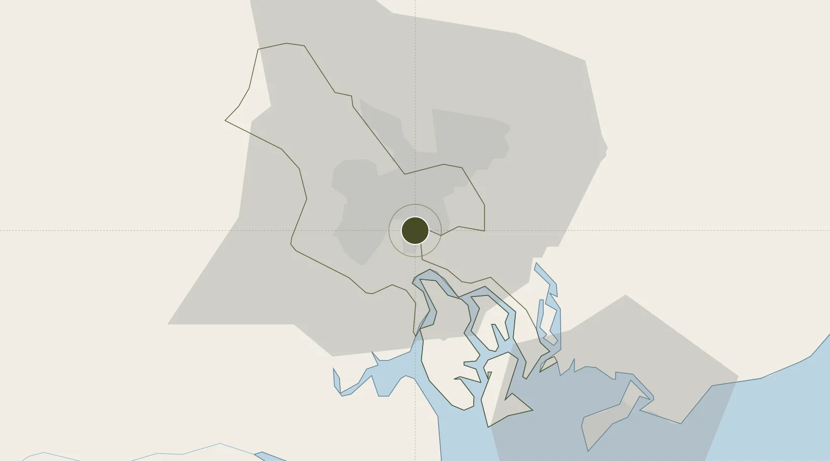
10.7628°, 106.7427°
300 ha
Zone area
2.9 km
Nearest port
11.7 km
Nearest airport

Gateway access

Nearest neighbours — logibook spatial index (haversine) over the source coordinates

Zone profile

Zone type
Export Processing Zone
the World Bank SEZ database
Region
Hồ Chí Minh city
the World Bank SEZ database
Established
1991
the World Bank SEZ database
Management
Private management
the World Bank SEZ database
Operator
Tan Thuan Company Limited
the World Bank SEZ database
Regulatory authority
Prime Minister
the World Bank SEZ database
Legal framework
Law on Foreign Investment in Vietnam, 1996; Decree No. 36/1997/CP on The Regulation of Industrial, Economic and Export processing zones
the World Bank SEZ database

Location

Location of VNM32
Natural Earth 10m (public domain) · Hồ Chí Minh city · VNM32 · 10.76, 106.74GoogleOSMYandex

Fiscal & incentives

Corporate tax
20%
the World Bank SEZ database
Tax relief
100% exempt
the World Bank SEZ database
Relief duration
4 years
the World Bank SEZ database
VAT
No exemption
the World Bank SEZ database
Import duty (inputs)
100% exempt
the World Bank SEZ database
Import duty (capex)
100% exempt
the World Bank SEZ database
Profit repatriation
No exemption
the World Bank SEZ database
Capital gains
No exemption
the World Bank SEZ database
Withholding tax
No exemption
the World Bank SEZ database
Min. investment
None
the World Bank SEZ database
Min. export
100%
the World Bank SEZ database
Employment incentive
No exemption
the World Bank SEZ database
Developer incentive
No established framework
the World Bank SEZ database

Nearby Logistics Neighbours

Ports
  1. 1Thanh Ho Chi Minh3 km
  2. 2Cat Lai5 km
  3. 3Thanh Hoa7 km
  4. 4Phu My38 km
  5. 5Vung Tau61 km
Nearest neighbours — logibook spatial index (haversine) over the source coordinates
Airports
  1. 1Tan Son Nhat International Airport12 km
  2. 2Long Thanh International Airport (Under Construction)33 km
  3. 3Can Tho International Airport136 km
  4. 4Rach Gia Airport198 km
  5. 5Lien Khuong Airport208 km
Nearest neighbours — logibook spatial index (haversine) over the source coordinates
Cities
  1. 1Bèn Nghè2 km
  2. 2Song Than ICD3 km
  3. 3Lotus Port3 km
  4. 4Cat Lai Oil Port4 km
  5. 5Tân Thuan Dông4 km
Nearest neighbours — logibook spatial index (haversine) over the source coordinates
Trade Zones
  1. 1Phu Gia Industrial Park10 km
  2. 2Hiep Phuoc Industrial Park14 km
  3. 3Song Than 1 Industrial Zone14 km
  4. 4Tan Binh Industrial Park14 km
  5. 5Song Than 2 Industrial Zone14 km
Nearest neighbours — logibook spatial index (haversine) over the source coordinates
DatabookThe Record of Consolidated Knowledge
Vietnam beyond logistics?
Browse databook

All Sources

Trade Zonesthe World Bank SEZ database
CC BY 4.0
Portsthe NGA World Port Index
Public domain (US gov)
AirportsOurAirports
Public domain
LocationsUN/LOCODE
UN/LOCODE — free
← Vietnam trade zones