UN/LOCODE hub · Vietnam
VNLTH

Long Thanh

10.7833°, 106.9500°
1
Transport functions

Transport Functions

Port
UN/LOCODE

Hub Profile

Place type
Provincial seat
GeoNames
Region
Dong Nai
GeoNames
Time zone
Asia/Ho_Chi_Minh
GeoNames
Elevation
19 m
GeoNames

Location

Location of VNLTH
Natural Earth 10m (public domain) · Dong Nai · VNLTH · 10.78, 106.95GoogleOSMYandex

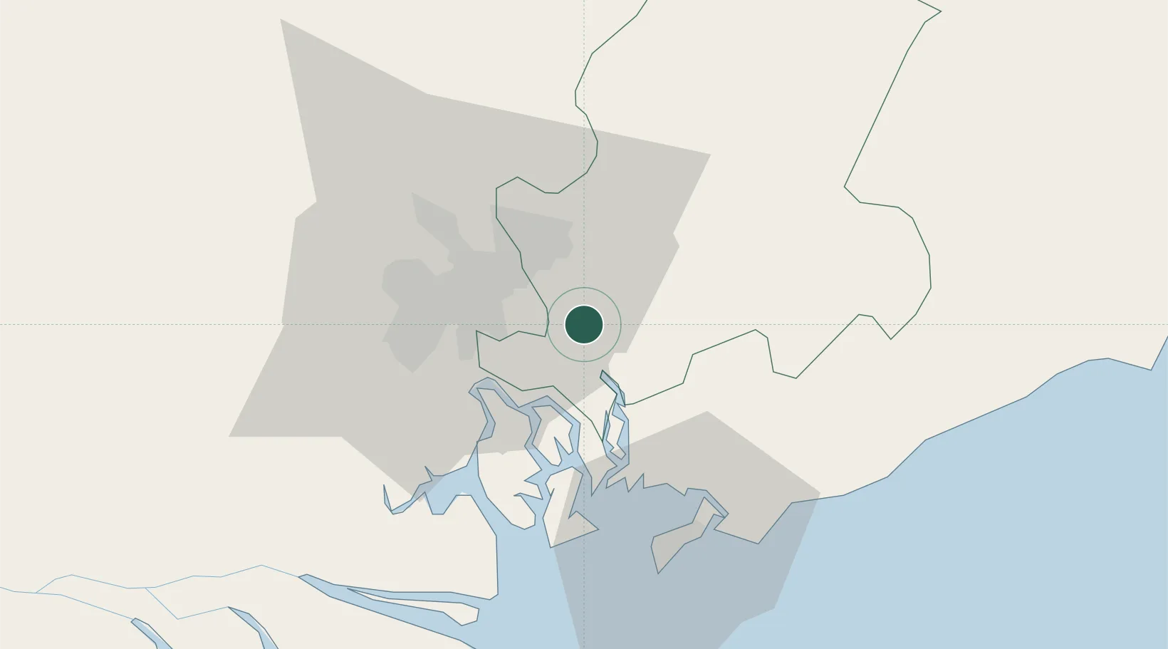
Nearby Logistics Neighbours

Cities
  1. 1Nhon Trach12 km
  2. 2Tan Cang - Long Binh ICD16 km
  3. 3Dong Nai16 km
  4. 4Go Dau A Terminal17 km
  5. 5Cát Lái17 km
Nearest neighbours — logibook spatial index (haversine) over the source coordinates
Ports
  1. 1Cat Lai19 km
  2. 2Thanh Hoa20 km
  3. 3Phu My24 km
  4. 4Thanh Ho Chi Minh26 km
  5. 5Vung Tau53 km
Nearest neighbours — logibook spatial index (haversine) over the source coordinates
Airports
  1. 1Long Thanh International Airport (Under Construction)10 km
  2. 2Tan Son Nhat International Airport33 km
  3. 3Can Tho International Airport156 km
  4. 4Lien Khuong Airport188 km
  5. 5Rach Gia Airport219 km
Nearest neighbours — logibook spatial index (haversine) over the source coordinates
Trade Zones
  1. 1Long Thanh Industrial Park5 km
  2. 2Nhon Trach I Industrial Park6 km
  3. 3Nhon Trach Ii Industrial Park7 km
  4. 4Nhon Trach Iii Industrial Park8 km
  5. 5Nhon Trach Ii - Nhon Phu Industrial Park8 km
Nearest neighbours — logibook spatial index (haversine) over the source coordinates
DatabookThe Record of Consolidated Knowledge
Vietnam beyond logistics?
Browse databook

All Sources

LocationsUN/LOCODE
UN/LOCODE — free
Portsthe NGA World Port Index
Public domain (US gov)
AirportsOurAirports
Public domain
Trade Zonesthe World Bank SEZ database
CC BY 4.0
Trade ZonesOpen Zone Map
CC BY
← Vietnam locations