UN/LOCODE hub · Vietnam
VNNHT

Nhon Trach

10.7264°, 106.8605°
3
Transport functions

Transport Functions

Port
Road
Multimodal
UN/LOCODE

Hub Profile

Place type
Provincial seat
GeoNames
Region
Dong Nai
GeoNames
Time zone
Asia/Ho_Chi_Minh
GeoNames
Elevation
26 m
GeoNames
Logistics facilities
3
UN/LOCODE

Location

Location of VNNHT
Natural Earth 10m (public domain) · Dong Nai · VNNHT · 10.73, 106.86GoogleOSMYandex

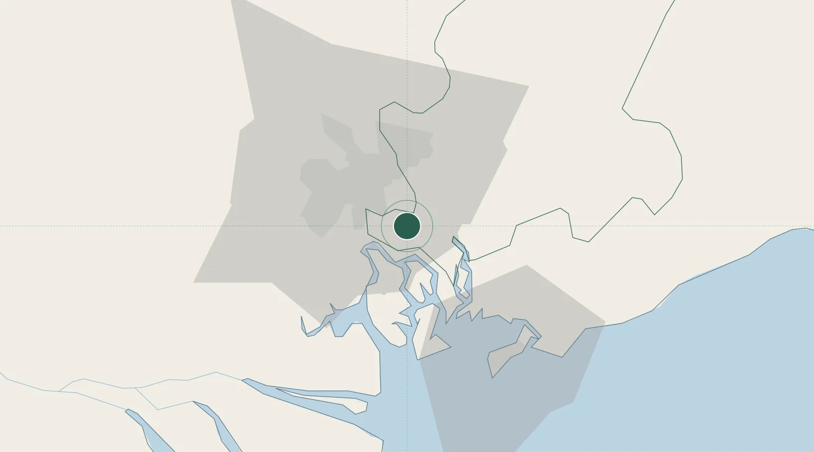
Nearby Logistics Neighbours

Cities
  1. 1Saigon Petro Oil Terminal9 km
  2. 2Cat Lai Oil Port10 km
  3. 3Cát Lái11 km
  4. 4Bông Sen11 km
  5. 5Long Thanh12 km
Nearest neighbours — logibook spatial index (haversine) over the source coordinates
Ports
  1. 1Cat Lai9 km
  2. 2Thanh Hoa14 km
  3. 3Thanh Ho Chi Minh16 km
  4. 4Phu My25 km
  5. 5Vung Tau51 km
Nearest neighbours — logibook spatial index (haversine) over the source coordinates
Airports
  1. 1Long Thanh International Airport (Under Construction)20 km
  2. 2Tan Son Nhat International Airport25 km
  3. 3Can Tho International Airport145 km
  4. 4Lien Khuong Airport200 km
  5. 5Rach Gia Airport207 km
Nearest neighbours — logibook spatial index (haversine) over the source coordinates
Trade Zones
  1. 1Nhon Trach Ii - Nhon Phu Industrial Park6 km
  2. 2Nhon Trach V Industrial Park6 km
  3. 3Nhon Trach I Industrial Park7 km
  4. 4Nhon Trach Textile Industrial Park (Vinatex - Tan Tao)7 km
  5. 5Nhon Trach Ii Industrial Park8 km
Nearest neighbours — logibook spatial index (haversine) over the source coordinates
DatabookThe Record of Consolidated Knowledge
Vietnam beyond logistics?
Browse databook

All Sources

LocationsUN/LOCODE
UN/LOCODE — free
Portsthe NGA World Port Index
Public domain (US gov)
AirportsOurAirports
Public domain
Trade Zonesthe World Bank SEZ database
CC BY 4.0
Trade ZonesOpen Zone Map
CC BY
← Vietnam locations