UN/LOCODE hub · Venezuela
VEPBL

Puerto Cabello

10.4730°, -68.0273°
174,000
Population
2
Transport functions
1
Container terminals

Transport Functions

Port
Airport
Puerto Cabello is also a profiled seaport →
UN/LOCODE

Hub Profile

Place type
Provincial seat
GeoNames
Region
Carabobo
GeoNames
Population
174,000
GeoNames
Time zone
America/Caracas
GeoNames
Elevation
10 m
GeoNames
Logistics facilities
7
UN/LOCODE
Container terminals
1
UN/LOCODE

Location

Location of VEPBL
Natural Earth 10m (public domain) · Carabobo · VEPBL · 10.47, -68.03GoogleOSMYandex

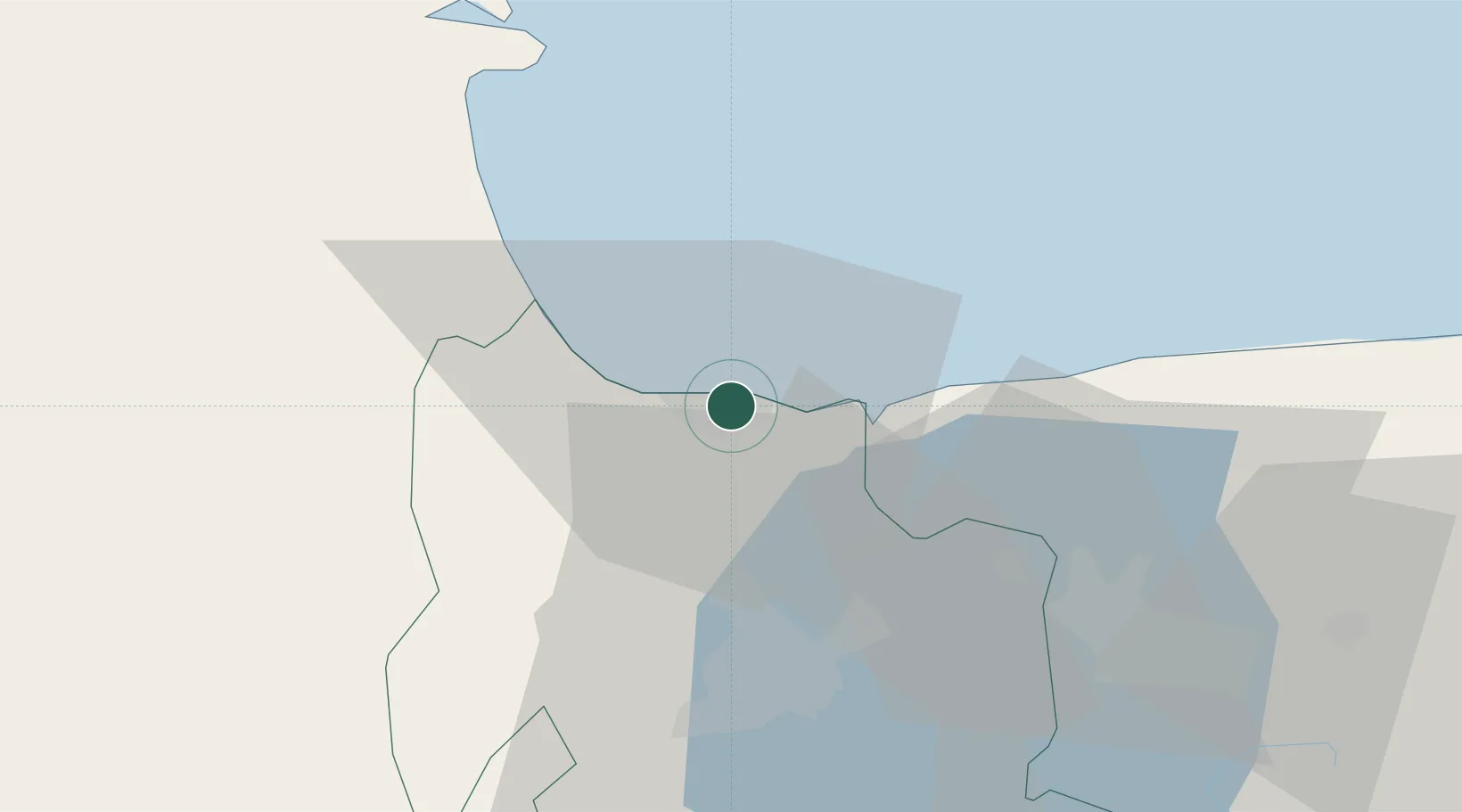
Nearby Logistics Neighbours

Cities
  1. 1Morón19 km
  2. 2San Diego27 km
  3. 3Los Guayos34 km
  4. 4El Consejo87 km
  5. 5El Junquito103 km
Nearest neighbours — logibook spatial index (haversine) over the source coordinates
Ports
  1. 1Puerto Borburata5 km
  2. 2El Palito10 km
  3. 3Puerto Chichiriviche56 km
  4. 4Catia La Mar111 km
  5. 5La Guaira121 km
Nearest neighbours — logibook spatial index (haversine) over the source coordinates
Airports
  1. 1General Bartolome Salom International Airport5 km
  2. 2Arturo Michelena International Airport38 km
  3. 3Escuela Mariscal Sucre Airport48 km
  4. 4El Libertador Airbase61 km
  5. 5Sub Teniente Nestor Arias Airport83 km
Nearest neighbours — logibook spatial index (haversine) over the source coordinates
Trade Zones
  1. 1Morón Puerto Cabello Special Economic Zone22 km
  2. 2Guarenas-Guatire Special Economic Zone157 km
  3. 3Harbor Free Zone Curaçao205 km
  4. 4Industrial Park Brievengat209 km
  5. 5Curaçao Airport Free Economic Zone216 km
Nearest neighbours — logibook spatial index (haversine) over the source coordinates
DatabookThe Record of Consolidated Knowledge
Venezuela beyond logistics?
Browse databook

All Sources

LocationsUN/LOCODE
UN/LOCODE — free
LocationsGeoNames
CC BY 4.0
Portsthe NGA World Port Index
Public domain (US gov)
AirportsOurAirports
Public domain
Trade Zonesthe World Bank SEZ database
CC BY 4.0
Trade ZonesOpen Zone Map
CC BY
← Venezuela locations