UN/LOCODE hub · United States
USYRE

Morehouse

36.8333°, -89.6833°
925
Population
4
Transport functions

Transport Functions

Port
Rail
Road
Multimodal
UN/LOCODE

Hub Profile

Place type
Populated place
GeoNames
Region
Missouri
GeoNames
Population
925
GeoNames
Time zone
America/Chicago
GeoNames
Elevation
92 m
GeoNames

Location

Location of USYRE
Natural Earth 10m (public domain) · Missouri · USYRE · 36.83, -89.68GoogleOSMYandex

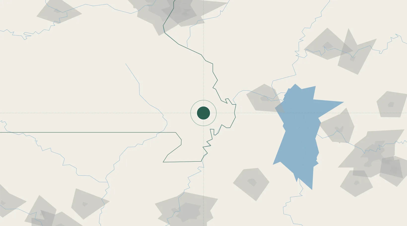
Nearby Logistics Neighbours

Cities
  1. 1Matthews13 km
  2. 2Holly Springs, Marshall22 km
  3. 3Bloomfield23 km
  4. 4Parma27 km
  5. 5Oran28 km
Nearest neighbours — logibook spatial index (haversine) over the source coordinates
Ports
  1. 1Port Of Memphis201 km
  2. 2Gary569 km
  3. 3Indiana Harbor571 km
  4. 4Calumet Harbor576 km
  5. 5Chicago589 km
Nearest neighbours — logibook spatial index (haversine) over the source coordinates
Airports
  1. 1Cape Girardeau Regional Airport45 km
  2. 2Barkley Regional Airport85 km
  3. 3Arkansas International Airport99 km
  4. 4Southern Illinois Airport112 km
  5. 5Veterans Airport of Southern Illinois118 km
Nearest neighbours — logibook spatial index (haversine) over the source coordinates
Trade Zones
  1. 1FTZ No. 294 Western Kentucky101 km
  2. 2FTZ No. 283 West Tennessee121 km
  3. 3FTZ No. 273 West Memphis193 km
  4. 4FTZ No. 223 Memphis193 km
  5. 5FTZ No. 077 Memphis196 km
Nearest neighbours — logibook spatial index (haversine) over the source coordinates
DatabookThe Record of Consolidated Knowledge
United States beyond logistics?
Browse databook

All Sources

LocationsUN/LOCODE
UN/LOCODE — free
LocationsGeoNames
CC BY 4.0
Portsthe NGA World Port Index
Public domain (US gov)
AirportsOurAirports
Public domain
Trade Zonesthe World Bank SEZ database
CC BY 4.0
Trade ZonesOpen Zone Map
CC BY
← United States locations