UN/LOCODE hub · United States
USUOL

Sunol

37.5833°, -121.8833°
913
Population
3
Transport functions

Transport Functions

Rail
Road
Multimodal
UN/LOCODE

Hub Profile

Place type
Populated place
GeoNames
Region
California
GeoNames
Population
913
GeoNames
Time zone
America/Los_Angeles
GeoNames
Elevation
84 m
GeoNames

Location

Location of USUOL
Natural Earth 10m (public domain) · California · USUOL · 37.58, -121.88GoogleOSMYandex

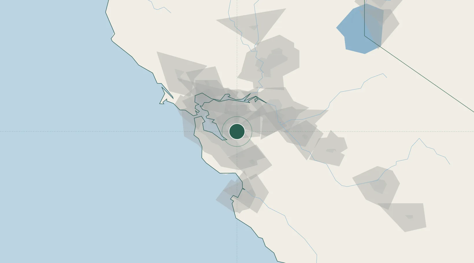
Nearby Logistics Neighbours

Cities
  1. 1Pleasanton9 km
  2. 2Hayward20 km
  3. 3San Lorenzo23 km
  4. 4San Jose31 km
  5. 5Woodside38 km
Nearest neighbours — logibook spatial index (haversine) over the source coordinates
Ports
  1. 1Redwood City29 km
  2. 2Alameda40 km
  3. 3Oakland47 km
  4. 4Berkeley48 km
  5. 5Antioch49 km
Nearest neighbours — logibook spatial index (haversine) over the source coordinates
Airports
  1. 1Moffett Federal Airfield24 km
  2. 2Palo Alto Airport25 km
  3. 3Norman Y. Mineta San Jose International Airport25 km
  4. 4San Carlos Airport33 km
  5. 5San Francisco Bay Oakland International Airport33 km
Nearest neighbours — logibook spatial index (haversine) over the source coordinates
Trade Zones
  1. 1FTZ No. 018 San Jose27 km
  2. 2FTZ No. 056 Oakland42 km
  3. 3FTZ No. 003 San Francisco51 km
  4. 4FTZ No. 231 Stockton64 km
  5. 5FTZ No. 143 West Sacramento115 km
Nearest neighbours — logibook spatial index (haversine) over the source coordinates
DatabookThe Record of Consolidated Knowledge
United States beyond logistics?
Browse databook

All Sources

LocationsUN/LOCODE
UN/LOCODE — free
LocationsGeoNames
CC BY 4.0
Portsthe NGA World Port Index
Public domain (US gov)
AirportsOurAirports
Public domain
Trade Zonesthe World Bank SEZ database
CC BY 4.0
Trade ZonesOpen Zone Map
CC BY
← United States locations