UN/LOCODE hub · United States
USRP2

Rego Park, Queens

40.7333°, -73.8500°
2
Transport functions

Transport Functions

Rail
Road
UN/LOCODE

Hub Profile

Region
NY
GeoNames

Location

Location of USRP2
Natural Earth 10m (public domain) · NY · USRP2 · 40.73, -73.85GoogleOSMYandex

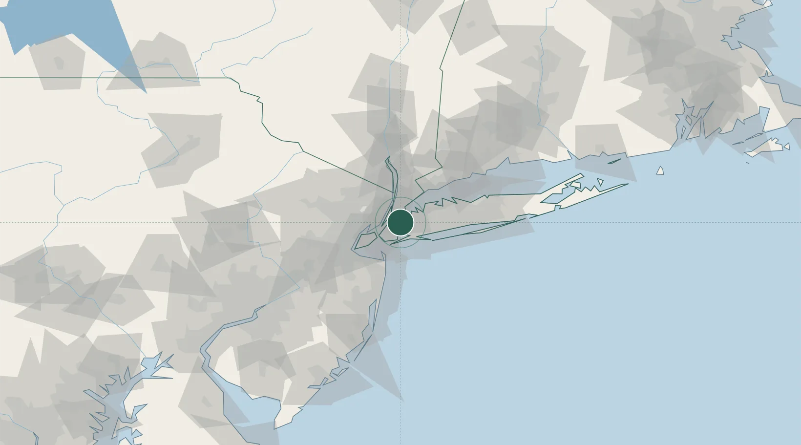
Nearby Logistics Neighbours

Cities
  1. 1Sunnyside, Queens6 km
  2. 2Woodhaven6 km
  3. 3Linden Hill7 km
  4. 4South Ozone Park8 km
  5. 5Port Morris, Bronx9 km
Nearest neighbours — logibook spatial index (haversine) over the source coordinates
Ports
  1. 1City Island14 km
  2. 2Hoboken14 km
  3. 3Weehawken15 km
  4. 4New York City15 km
  5. 5Edgewater15 km
Nearest neighbours — logibook spatial index (haversine) over the source coordinates
Airports
  1. 1LaGuardia Airport5 km
  2. 2East 34th Street Heliport10 km
  3. 3New York Skyports Inc Seaplane Base10 km
  4. 4John F. Kennedy International Airport12 km
  5. 5West 30th Street Heliport13 km
Nearest neighbours — logibook spatial index (haversine) over the source coordinates
Trade Zones
  1. 1FTZ No. 001 New York City14 km
  2. 2FTZ No. 049 Newark Elizabeth28 km
  3. 3FTZ No. 052 Suffolk County59 km
  4. 4FTZ No. 076 Bridgeport74 km
  5. 5FTZ No. 235 Lakewood81 km
Nearest neighbours — logibook spatial index (haversine) over the source coordinates
DatabookThe Record of Consolidated Knowledge
United States beyond logistics?
Browse databook

All Sources

LocationsUN/LOCODE
UN/LOCODE — free
Portsthe NGA World Port Index
Public domain (US gov)
AirportsOurAirports
Public domain
Trade Zonesthe World Bank SEZ database
CC BY 4.0
Trade ZonesOpen Zone Map
CC BY
← United States locations