UN/LOCODE hub · United States
USNII

Niantic

41.3167°, -72.1833°
3,114
Population
3
Transport functions

Transport Functions

Rail
Road
Multimodal
UN/LOCODE

Hub Profile

Place type
Populated place
GeoNames
Region
Connecticut
GeoNames
Population
3,114
GeoNames
Time zone
America/New_York
GeoNames
Elevation
9 m
GeoNames

Location

Location of USNII
Natural Earth 10m (public domain) · Connecticut · USNII · 41.32, -72.18GoogleOSMYandex

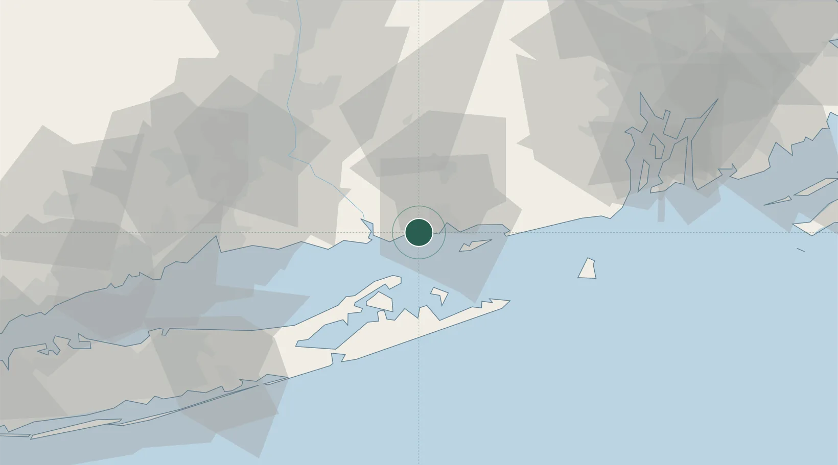
Nearby Logistics Neighbours

Cities
  1. 1East Lyme2 km
  2. 2Waterford6 km
  3. 3Gales Ferry14 km
  4. 4Mystic20 km
  5. 5Stonington24 km
Nearest neighbours — logibook spatial index (haversine) over the source coordinates
Ports
  1. 1New London9 km
  2. 2Noank17 km
  3. 3Essex17 km
  4. 4Mystic19 km
  5. 5Stonington24 km
Nearest neighbours — logibook spatial index (haversine) over the source coordinates
Airports
  1. 1Groton New London Airport12 km
  2. 2Westerly State Airport32 km
  3. 3Montauk Airport35 km
  4. 4Block Island State Airport53 km
  5. 5Tweed New Haven Airport59 km
Nearest neighbours — logibook spatial index (haversine) over the source coordinates
Trade Zones
  1. 1FTZ No. 208 New London8 km
  2. 2FTZ No. 162 New Haven62 km
  3. 3FTZ No. 071 Windsor Locks78 km
  4. 4FTZ No. 105 Providence and North Kingstown82 km
  5. 5FTZ No. 076 Bridgeport86 km
Nearest neighbours — logibook spatial index (haversine) over the source coordinates
DatabookThe Record of Consolidated Knowledge
United States beyond logistics?
Browse databook

All Sources

LocationsUN/LOCODE
UN/LOCODE — free
LocationsGeoNames
CC BY 4.0
Portsthe NGA World Port Index
Public domain (US gov)
AirportsOurAirports
Public domain
Trade Zonesthe World Bank SEZ database
CC BY 4.0
Trade ZonesOpen Zone Map
CC BY
← United States locations