UN/LOCODE hub · United States
USHMG

Hamilton, Monmouth

40.2000°, -74.0833°
2
Transport functions

Transport Functions

Road
Multimodal
UN/LOCODE

Hub Profile

Region
NJ
GeoNames

Location

Location of USHMG
Natural Earth 10m (public domain) · NJ · USHMG · 40.20, -74.08GoogleOSMYandex

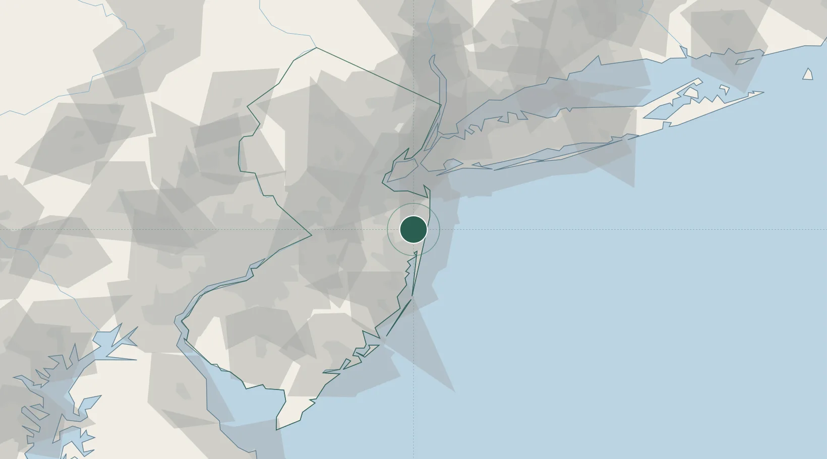
Nearby Logistics Neighbours

Cities
  1. 1Neptune City6 km
  2. 2Avon-by-the-Sea7 km
  3. 3Allenwood8 km
  4. 4Deal8 km
  5. 5Manasquan10 km
Nearest neighbours — logibook spatial index (haversine) over the source coordinates
Ports
  1. 1Leonardo26 km
  2. 2South Amboy35 km
  3. 3Perth Amboy37 km
  4. 4Sayreville38 km
  5. 5Sewaren41 km
Nearest neighbours — logibook spatial index (haversine) over the source coordinates
Airports
  1. 1Lakehurst Maxfield Field Airport30 km
  2. 2Mc Guire Air Force Base48 km
  3. 3Newark Liberty International Airport55 km
  4. 4John F. Kennedy International Airport55 km
  5. 5New York Skyports Inc Seaplane Base60 km
Nearest neighbours — logibook spatial index (haversine) over the source coordinates
Trade Zones
  1. 1FTZ No. 235 Lakewood20 km
  2. 2FTZ No. 049 Newark Elizabeth55 km
  3. 3FTZ No. 001 New York City57 km
  4. 4FTZ No. 200 Mercer County66 km
  5. 5FTZ No. 044 Morris County99 km
Nearest neighbours — logibook spatial index (haversine) over the source coordinates
DatabookThe Record of Consolidated Knowledge
United States beyond logistics?
Browse databook

All Sources

LocationsUN/LOCODE
UN/LOCODE — free
Portsthe NGA World Port Index
Public domain (US gov)
AirportsOurAirports
Public domain
Trade Zonesthe World Bank SEZ database
CC BY 4.0
Trade ZonesOpen Zone Map
CC BY
← United States locations