UN/LOCODE hub · United States
USE3C

Eagle Creek

45.3500°, -122.3500°
2
Transport functions

Transport Functions

Rail
Road
UN/LOCODE

Hub Profile

Place type
Populated place
GeoNames
Region
Oregon
GeoNames
Time zone
America/Los_Angeles
GeoNames
Elevation
105 m
GeoNames

Location

Location of USE3C
Natural Earth 10m (public domain) · Oregon · USE3C · 45.35, -122.35GoogleOSMYandex

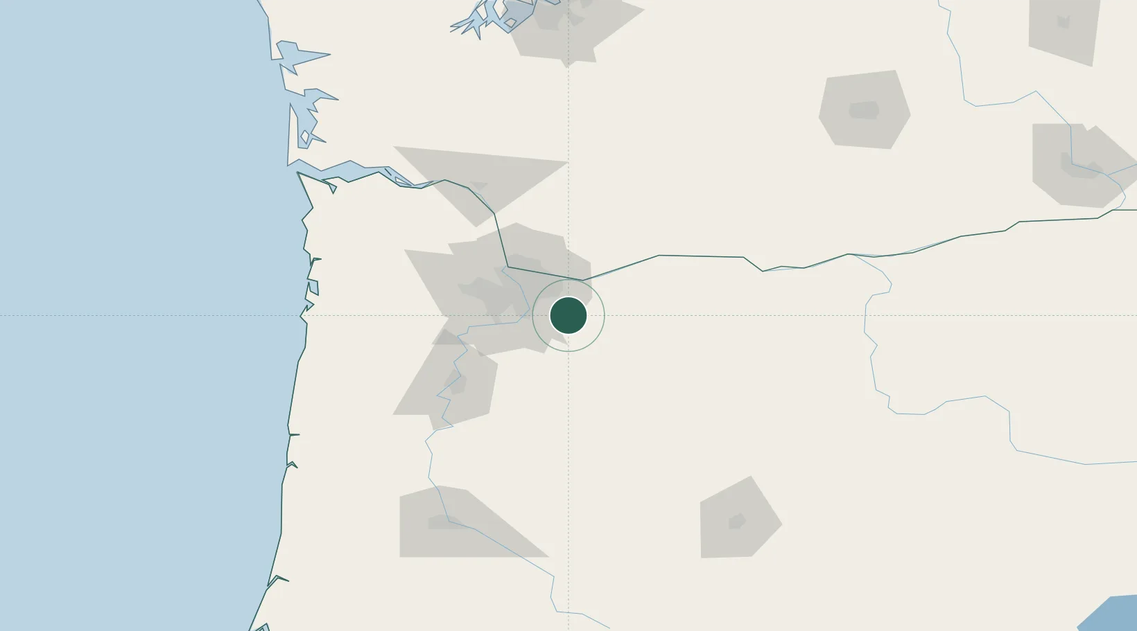
Nearby Logistics Neighbours

Cities
  1. 1Beaver Creek16 km
  2. 2Brightwood27 km
  3. 3Portland31 km
  4. 4Vancouver40 km
  5. 5Donald41 km
Nearest neighbours — logibook spatial index (haversine) over the source coordinates
Ports
  1. 1Washougal26 km
  2. 2Camas26 km
  3. 3Portland31 km
  4. 4Vancouver41 km
  5. 5St Helens67 km
Nearest neighbours — logibook spatial index (haversine) over the source coordinates
Airports
  1. 1Portland Troutdale Airport23 km
  2. 2Portland International Airport33 km
  3. 3Aurora State Airport35 km
  4. 4Portland Hillsboro Airport51 km
  5. 5McMinnville Municipal Airport64 km
Nearest neighbours — logibook spatial index (haversine) over the source coordinates
Trade Zones
  1. 1FTZ No. 045 Portland41 km
  2. 2FTZ No. 296 Vancouver42 km
  3. 3FTZ No. 255 Washington County84 km
  4. 4FTZ No. 120 Cowlitz County100 km
  5. 5FTZ No. 216 Olympia193 km
Nearest neighbours — logibook spatial index (haversine) over the source coordinates
DatabookThe Record of Consolidated Knowledge
United States beyond logistics?
Browse databook

All Sources

LocationsUN/LOCODE
UN/LOCODE — free
Portsthe NGA World Port Index
Public domain (US gov)
AirportsOurAirports
Public domain
Trade Zonesthe World Bank SEZ database
CC BY 4.0
Trade ZonesOpen Zone Map
CC BY
← United States locations