UN/LOCODE hub · United States
USDLQ

Deer Lake, Schuylkill

40.6167°, -76.0500°
2
Transport functions

Transport Functions

Road
Multimodal
UN/LOCODE

Hub Profile

Region
PA
GeoNames

Location

Location of USDLQ
Natural Earth 10m (public domain) · PA · USDLQ · 40.62, -76.05GoogleOSMYandex

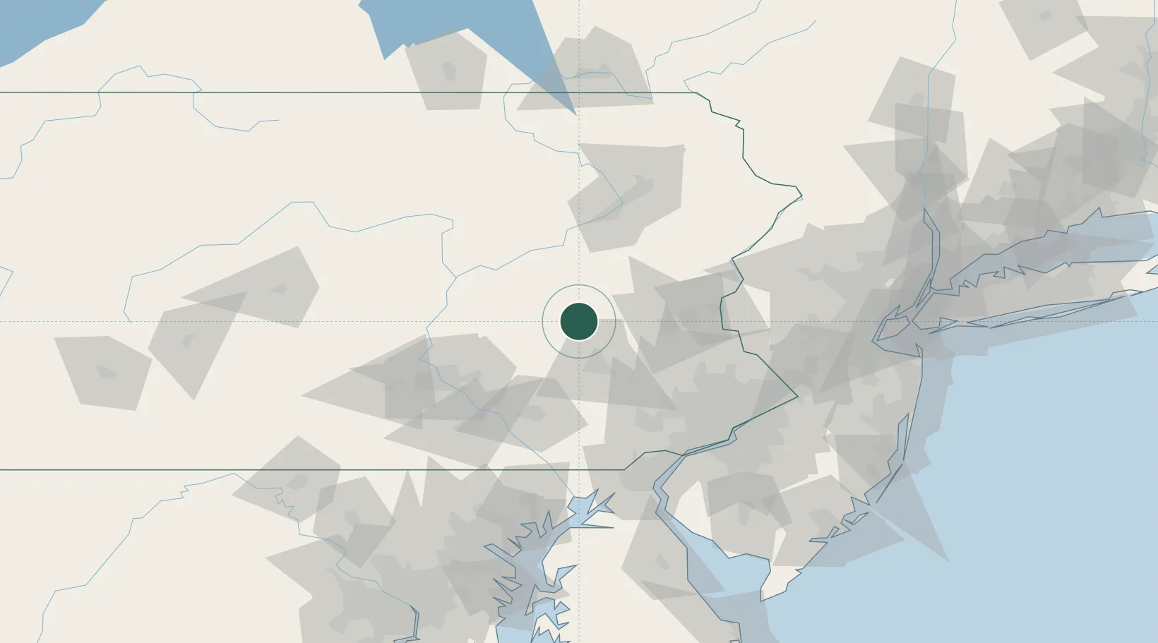
Nearby Logistics Neighbours

Cities
  1. 1Hamburg8 km
  2. 2Port Carbon12 km
  3. 3Shoemakersville15 km
  4. 4Saint Clair16 km
  5. 5Marlin18 km
Nearest neighbours — logibook spatial index (haversine) over the source coordinates
Ports
  1. 1Chester104 km
  2. 2Marcus Hook104 km
  3. 3Wilmington107 km
  4. 4Philadelphia107 km
  5. 5Camden107 km
Nearest neighbours — logibook spatial index (haversine) over the source coordinates
Airports
  1. 1Reading Regional Airport (Carl A Spaatz Field)27 km
  2. 2Muir Army Air Field (Fort Indiantown Gap) Airport48 km
  3. 3Lehigh Valley International Airport51 km
  4. 4Lancaster Airport59 km
  5. 5Harrisburg International Airport77 km
Nearest neighbours — logibook spatial index (haversine) over the source coordinates
Trade Zones
  1. 1FTZ No. 272 Counties of Lehigh and Northampton27 km
  2. 2FTZ No. 147 Berks County30 km
  3. 3FTZ No. 024 Pittston82 km
  4. 4FTZ No. 035 Philadelphia96 km
  5. 5FTZ No. 044 Morris County104 km
Nearest neighbours — logibook spatial index (haversine) over the source coordinates
DatabookThe Record of Consolidated Knowledge
United States beyond logistics?
Browse databook

All Sources

LocationsUN/LOCODE
UN/LOCODE — free
Portsthe NGA World Port Index
Public domain (US gov)
AirportsOurAirports
Public domain
Trade Zonesthe World Bank SEZ database
CC BY 4.0
Trade ZonesOpen Zone Map
CC BY
← United States locations