UN/LOCODE hub · Sweden
SEOST

Östrand

62.4667°, 17.3167°
1
Transport functions

Transport Functions

Port
UN/LOCODE

Hub Profile

Place type
Populated place
GeoNames
Region
Västernorrland
GeoNames
Time zone
Europe/Stockholm
GeoNames
Elevation
31 m
GeoNames

Location

Location of SEOST
Natural Earth 10m (public domain) · Västernorrland · SEOST · 62.47, 17.32GoogleOSMYandex

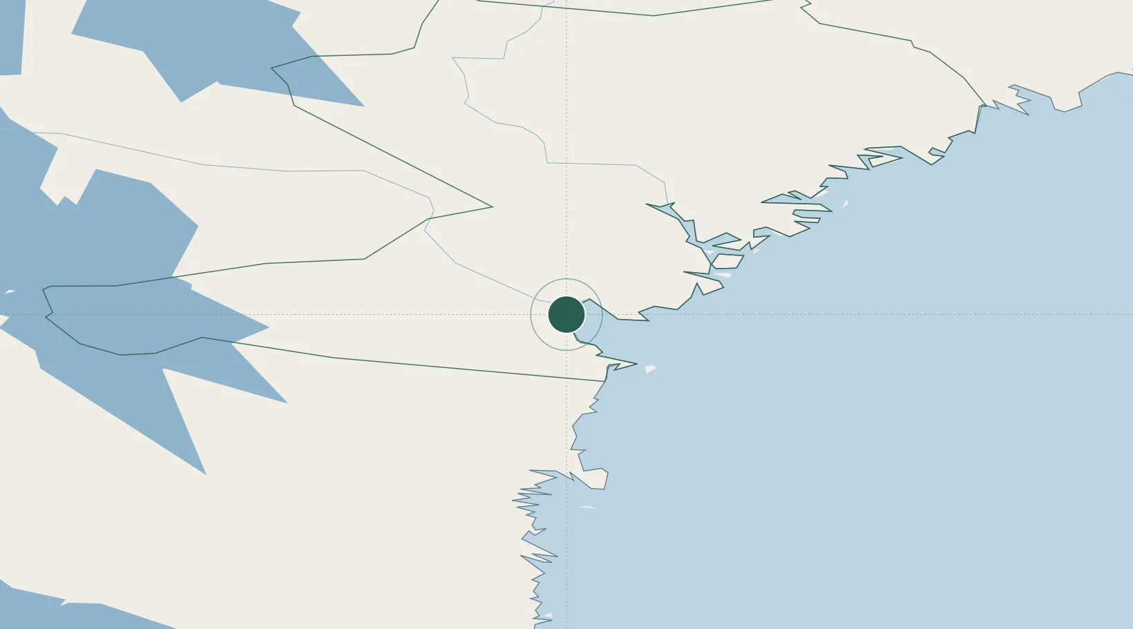
Nearby Logistics Neighbours

Cities
  1. 1Sundsbruk3 km
  2. 2Sundsvall7 km
  3. 3Tunadal8 km
  4. 4Ortviken9 km
  5. 5Söråker10 km
Nearest neighbours — logibook spatial index (haversine) over the source coordinates
Ports
  1. 1Vivstavarv3 km
  2. 2Sundsvall9 km
  3. 3Soraker10 km
  4. 4Stockvik15 km
  5. 5Harnosand37 km
Nearest neighbours — logibook spatial index (haversine) over the source coordinates
Airports
  1. 1Sundsvall-Härnösand Airport10 km
  2. 2Kramfors-Sollefteå Höga Kusten Airport69 km
  3. 3Söderhamn Airport135 km
  4. 4Örnsköldsvik Airport135 km
  5. 5Sveg Airport157 km
Nearest neighbours — logibook spatial index (haversine) over the source coordinates
Trade Zones
  1. 1Turku Free Zone344 km
  2. 2Stockholm Free Zone349 km
  3. 3Freeport of Hanko418 km
  4. 4Oulu Port Free Warehouse Area487 km
  5. 5Paldiski Free Zone505 km
Nearest neighbours — logibook spatial index (haversine) over the source coordinates
DatabookThe Record of Consolidated Knowledge
Sweden beyond logistics?
Browse databook

All Sources

LocationsUN/LOCODE
UN/LOCODE — free
Portsthe NGA World Port Index
Public domain (US gov)
AirportsOurAirports
Public domain
Trade Zonesthe World Bank SEZ database
CC BY 4.0
Trade ZonesOpen Zone Map
CC BY
← Sweden locations