UN/LOCODE hub · Sweden
SEADK

Adak

65.3500°, 18.6167°
1
Transport functions

Transport Functions

Multimodal
UN/LOCODE

Hub Profile

Place type
Populated place
GeoNames
Region
Västerbotten
GeoNames
Time zone
Europe/Stockholm
GeoNames
Elevation
403 m
GeoNames

Location

Location of SEADK
Natural Earth 10m (public domain) · Västerbotten · SEADK · 65.35, 18.62GoogleOSMYandex

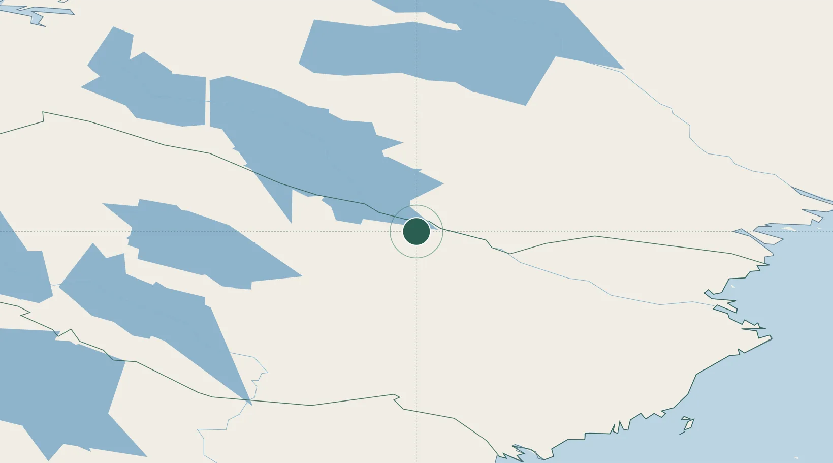
Nearby Logistics Neighbours

Cities
  1. 1Storuman76 km
  2. 2Skellefteå127 km
  3. 3Öjebyn129 km
  4. 4Piteå140 km
  5. 5Haraholmen142 km
Nearest neighbours — logibook spatial index (haversine) over the source coordinates
Ports
  1. 1Pitea133 km
  2. 2Brannfors134 km
  3. 3Skelleftehamn144 km
  4. 4Obbola201 km
  5. 5Umea Hamn201 km
Nearest neighbours — logibook spatial index (haversine) over the source coordinates
Airports
  1. 1Arvidsjaur Airport41 km
  2. 2Storuman Airport61 km
  3. 3Lycksele Airport89 km
  4. 4Vilhelmina South Lapland Airport120 km
  5. 5Skellefteå Airport141 km
Nearest neighbours — logibook spatial index (haversine) over the source coordinates
Trade Zones
  1. 1Oulu Port Free Warehouse Area320 km
  2. 2Turku Free Zone575 km
  3. 3Freeport of Hanko651 km
  4. 4Stockholm Free Zone668 km
  5. 5Port of Hamina-Kotka686 km
Nearest neighbours — logibook spatial index (haversine) over the source coordinates
DatabookThe Record of Consolidated Knowledge
Sweden beyond logistics?
Browse databook

All Sources

LocationsUN/LOCODE
UN/LOCODE — free
Portsthe NGA World Port Index
Public domain (US gov)
AirportsOurAirports
Public domain
Trade Zonesthe World Bank SEZ database
CC BY 4.0
Trade ZonesOpen Zone Map
CC BY
← Sweden locations