UN/LOCODE hub · Pakistan
PKHAY

Hayatabad

34.2667°, 71.6833°
1
Transport functions

Transport Functions

Multimodal
UN/LOCODE

Hub Profile

Place type
Urban district
GeoNames
Region
Khyber Pakhtunkhwa
GeoNames
Time zone
Asia/Karachi
GeoNames
Elevation
393 m
GeoNames

Location

Location of PKHAY
Natural Earth 10m (public domain) · Khyber Pakhtunkhwa · PKHAY · 34.27, 71.68GoogleOSMYandex

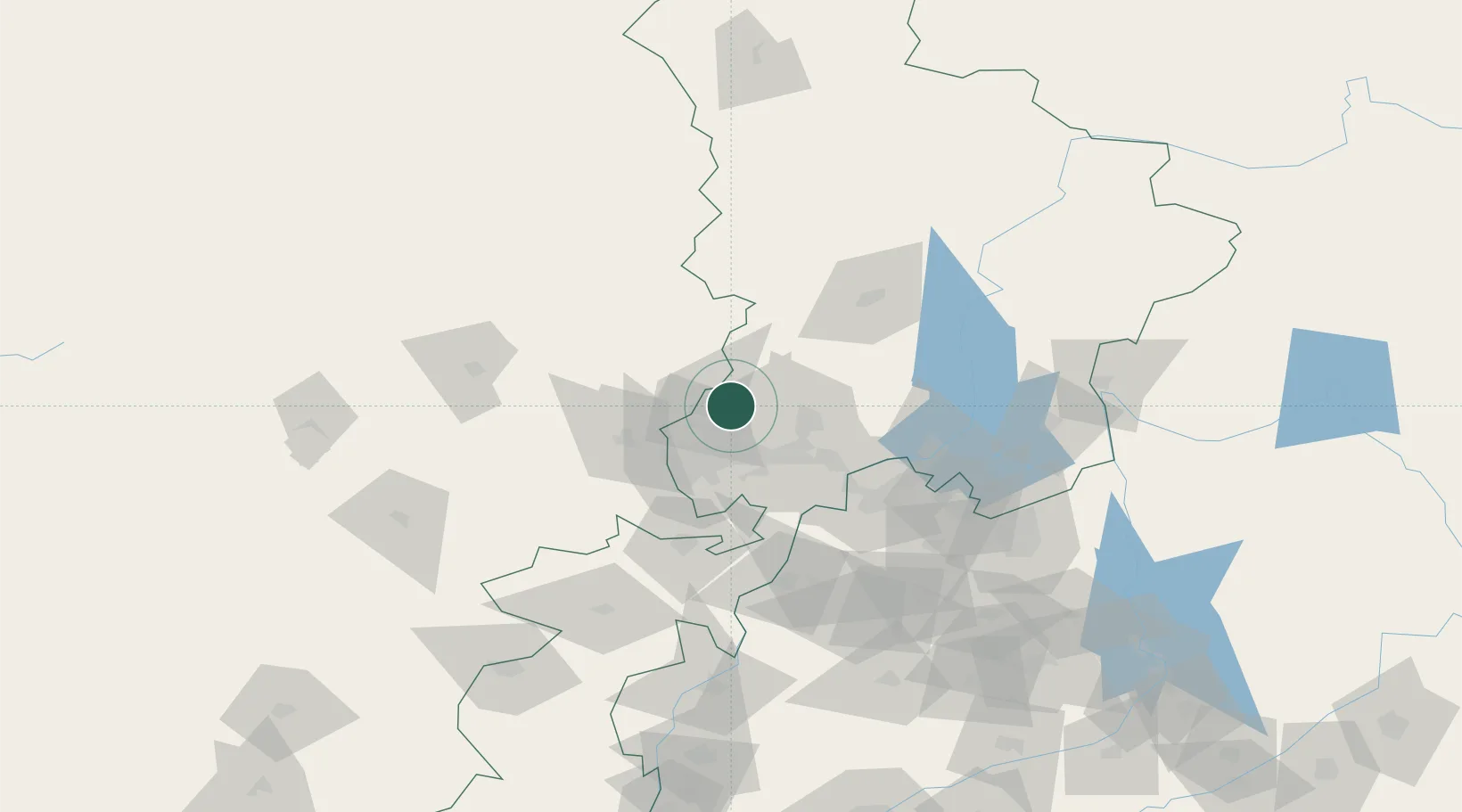
Nearby Logistics Neighbours

Cities
  1. 1Torkham72 km
  2. 2Qasim86 km
  3. 3Garhi Habibullah Khan157 km
  4. 4Jhelum241 km
  5. 5Sharona243 km
Nearest neighbours — logibook spatial index (haversine) over the source coordinates
Ports
  1. 1Muhamamad Bin Qasim1136 km
  2. 2Karachi1148 km
  3. 3Kandla1257 km
  4. 4Navlakhi1263 km
  5. 5Mandvi1292 km
Nearest neighbours — logibook spatial index (haversine) over the source coordinates
Airports
  1. 1Risalpur Air Base34 km
  2. 2Bacha Khan International Airport34 km
  3. 3Minhas Air Base80 km
  4. 4Saidu Sharif Airport86 km
  5. 5Jalalabad Airport110 km
Nearest neighbours — logibook spatial index (haversine) over the source coordinates
Trade Zones
  1. 1Mohmand Marble City28 km
  2. 2Risalpur Export Processing Zone34 km
  3. 3Rashakai Nowshehra Special Economic Zone48 km
  4. 4Jalalabad Special Economic Zone110 km
  5. 5Nangarhar Special Economic Zone111 km
Nearest neighbours — logibook spatial index (haversine) over the source coordinates
DatabookThe Record of Consolidated Knowledge
Pakistan beyond logistics?
Browse databook

All Sources

LocationsUN/LOCODE
UN/LOCODE — free
Portsthe NGA World Port Index
Public domain (US gov)
AirportsOurAirports
Public domain
Trade Zonesthe World Bank SEZ database
CC BY 4.0
Trade ZonesOpen Zone Map
CC BY
← Pakistan locations