UN/LOCODE hub · Philippines
PHHIL

Hilongos

10.3667°, 124.7500°
7,329
Population
1
Transport functions

Transport Functions

Port
UN/LOCODE

Hub Profile

Place type
Populated place
GeoNames
Region
Eastern Visayas
GeoNames
Population
7,329
GeoNames
Time zone
Asia/Manila
GeoNames
Elevation
5 m
GeoNames

Location

Location of PHHIL
Natural Earth 10m (public domain) · Eastern Visayas · PHHIL · 10.37, 124.75GoogleOSMYandex

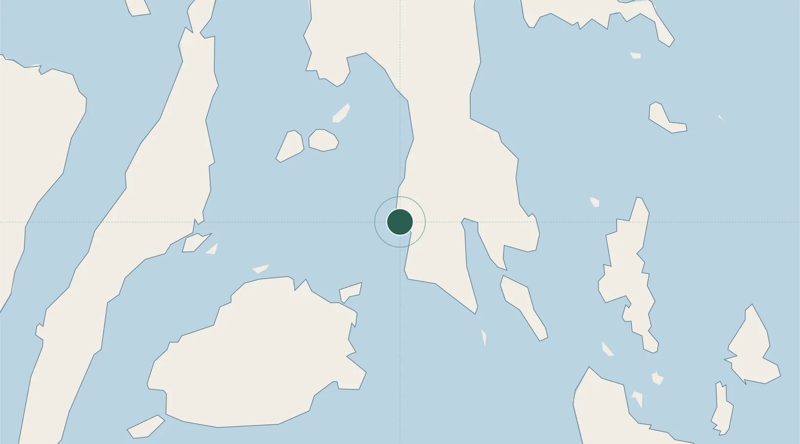
Nearby Logistics Neighbours

Cities
  1. 1Talibon54 km
  2. 2Albuera68 km
  3. 3Danao81 km
  4. 4Mactan Island Apt82 km
  5. 5Lapu-Lapu, Cebu88 km
Nearest neighbours — logibook spatial index (haversine) over the source coordinates
Ports
  1. 1Maasin28 km
  2. 2Baybay36 km
  3. 3Isabel70 km
  4. 4Ormoc72 km
  5. 5Palompon86 km
Nearest neighbours — logibook spatial index (haversine) over the source coordinates
Airports
  1. 1Ormoc Airport79 km
  2. 2Mactan Cebu International Airport85 km
  3. 3Daniel Z. Romualdez Airport100 km
  4. 4Surigao Airport105 km
  5. 5Camiguin Airport124 km
Nearest neighbours — logibook spatial index (haversine) over the source coordinates
Trade Zones
  1. 1New Jubilee Agro-Industrial Economic Zone51 km
  2. 2Leyte Industrial Development Estate69 km
  3. 3MRI Ecozone80 km
  4. 4The Mactan Newtown81 km
  5. 5Mactan Economic Zone84 km
Nearest neighbours — logibook spatial index (haversine) over the source coordinates
DatabookThe Record of Consolidated Knowledge
Philippines beyond logistics?
Browse databook

All Sources

LocationsUN/LOCODE
UN/LOCODE — free
LocationsGeoNames
CC BY 4.0
Portsthe NGA World Port Index
Public domain (US gov)
AirportsOurAirports
Public domain
Trade Zonesthe World Bank SEZ database
CC BY 4.0
Trade ZonesOpen Zone Map
CC BY
← Philippines locations