UN/LOCODE hub · New Zealand
NZKUE

Kumeu

-36.7667°, 174.5667°
8,510
Population
1
Transport functions

Transport Functions

Multimodal
UN/LOCODE

Hub Profile

Place type
Populated place
GeoNames
Region
Auckland
GeoNames
Population
8,510
GeoNames
Time zone
Pacific/Auckland
GeoNames
Elevation
69 m
GeoNames

Location

Location of NZKUE
Natural Earth 10m (public domain) · Auckland · NZKUE · -36.77, 174.57GoogleOSMYandex

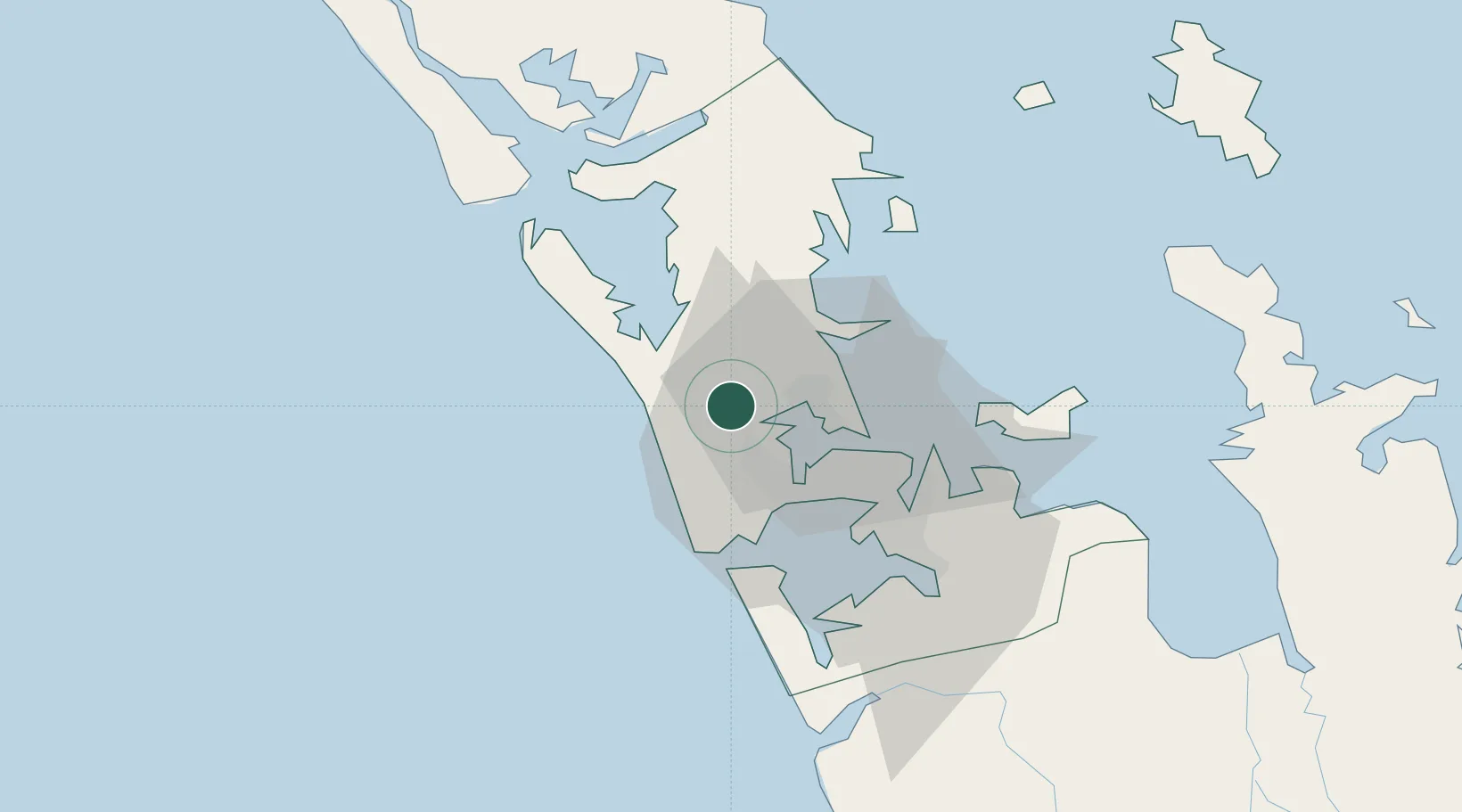
Nearby Logistics Neighbours

Cities
  1. 1Waitakere9 km
  2. 2Kauri Point12 km
  3. 3Henderson12 km
  4. 4Chelsea15 km
  5. 5Herne Bay15 km
Nearest neighbours — logibook spatial index (haversine) over the source coordinates
Ports
  1. 1Auckland20 km
  2. 2Manukau Harbor27 km
  3. 3Whangarei108 km
  4. 4Opua166 km
  5. 5Tauranga171 km
Nearest neighbours — logibook spatial index (haversine) over the source coordinates
Airports
  1. 1RNZAF Base Auckland-Whenuapai6 km
  2. 2Auckland International Airport34 km
  3. 3Ardmore Airport47 km
  4. 4Great Barrier Aerodrome100 km
  5. 5Okiwi Station Airport103 km
Nearest neighbours — logibook spatial index (haversine) over the source coordinates
Trade Zones
  1. 1Hicks Bay Area Special Economic Zone329 km
  2. 2Rotuma-Kadavu Tax-Free Region2105 km
  3. 3Kalabu Tax Free Zone2112 km
  4. 4Nausori-Ba Tax-Free Region2120 km
  5. 5Lautoka Special Zone2147 km
Nearest neighbours — logibook spatial index (haversine) over the source coordinates
DatabookThe Record of Consolidated Knowledge
New Zealand beyond logistics?
Browse databook

All Sources

LocationsUN/LOCODE
UN/LOCODE — free
LocationsGeoNames
CC BY 4.0
Portsthe NGA World Port Index
Public domain (US gov)
AirportsOurAirports
Public domain
Trade Zonesthe World Bank SEZ database
CC BY 4.0
Trade ZonesOpen Zone Map
CC BY
← New Zealand locations