UN/LOCODE hub · Norway
NOSVT

Stavneset - Rissa

63.7000°, 9.9500°
1
Transport functions

Transport Functions

Port
UN/LOCODE

Hub Profile

Region
16
GeoNames

Location

Location of NOSVT
Natural Earth 10m (public domain) · 16 · NOSVT · 63.70, 9.95GoogleOSMYandex

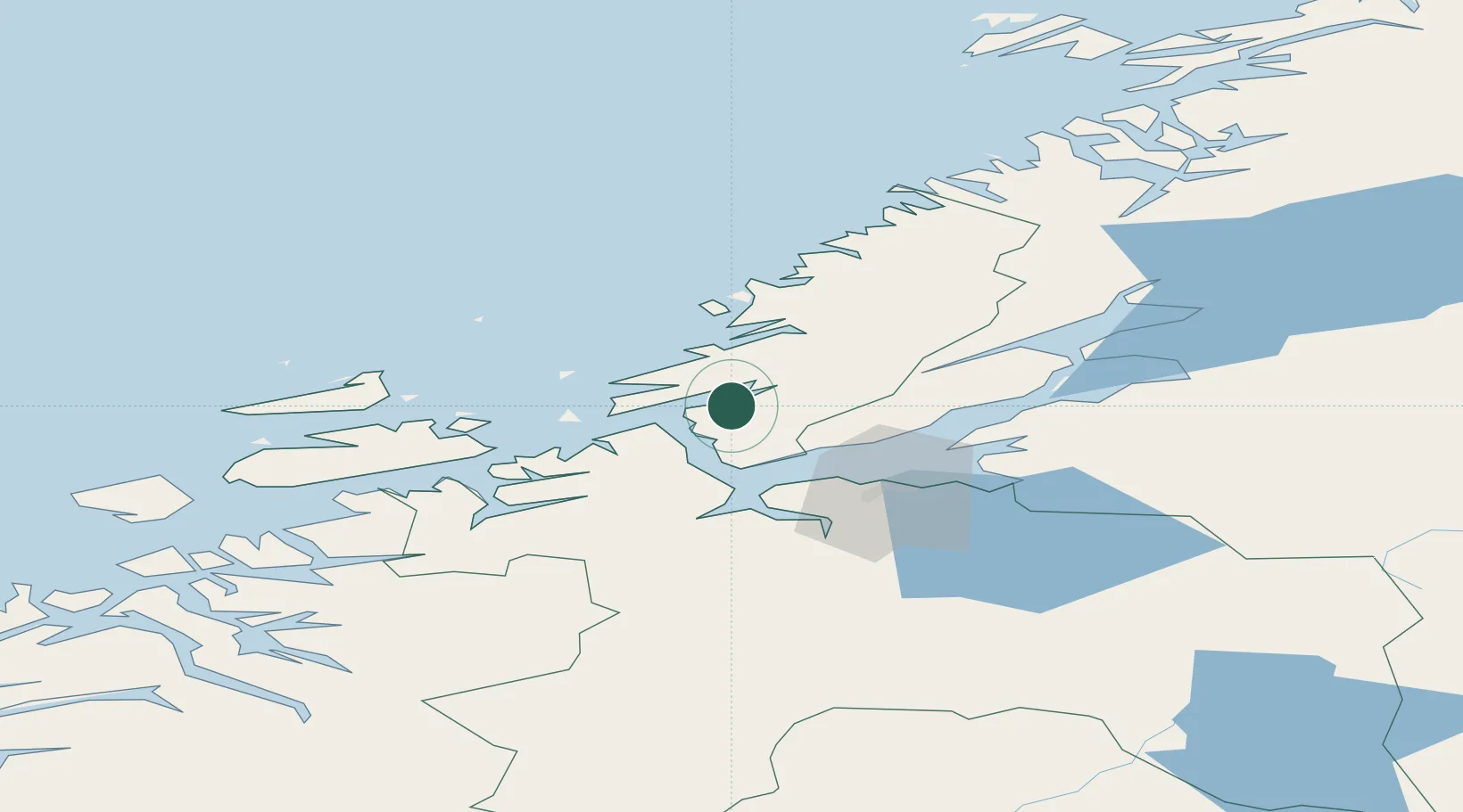
Nearby Logistics Neighbours

Cities
  1. 1Bjugn11 km
  2. 2Rissa13 km
  3. 3Brekstad13 km
  4. 4Selva14 km
  5. 5Kvithylla15 km
Nearest neighbours — logibook spatial index (haversine) over the source coordinates
Ports
  1. 1Trondheim36 km
  2. 2Langstein49 km
  3. 3Hommelvik53 km
  4. 4Muruvik53 km
  5. 5Fiborgtangen59 km
Nearest neighbours — logibook spatial index (haversine) over the source coordinates
Airports
  1. 1Ørland Airport17 km
  2. 2Trondheim Airport, Værnes55 km
  3. 3Namsos Airport117 km
  4. 4Kristiansund Airport, Kvernberget124 km
  5. 5Rørvik Airport, Ryum139 km
Nearest neighbours — logibook spatial index (haversine) over the source coordinates
Trade Zones
  1. 1Stockholm Free Zone648 km
  2. 2Gothenburg Boundless Customs Warehouse674 km
  3. 3Jönköping Free Zone697 km
  4. 4Freeport of Copenhagen- Nordhavn900 km
  5. 5MTS Malmö Transport and Spedition917 km
Nearest neighbours — logibook spatial index (haversine) over the source coordinates
DatabookThe Record of Consolidated Knowledge
Norway beyond logistics?
Browse databook

All Sources

LocationsUN/LOCODE
UN/LOCODE — free
Portsthe NGA World Port Index
Public domain (US gov)
AirportsOurAirports
Public domain
Trade Zonesthe World Bank SEZ database
CC BY 4.0
Trade ZonesOpen Zone Map
CC BY
← Norway locations