UN/LOCODE hub · Norway
NOSTI

Steinvig

58.9667°, 6.0000°
1
Transport functions

Transport Functions

Port
UN/LOCODE

Hub Profile

Region
11
GeoNames

Location

Location of NOSTI
Natural Earth 10m (public domain) · 11 · NOSTI · 58.97, 6.00GoogleOSMYandex

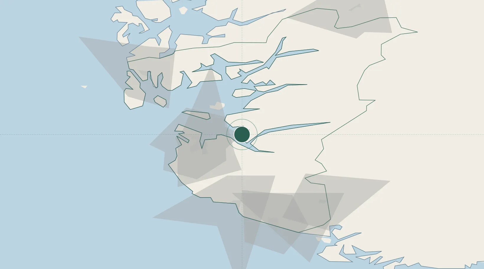
Nearby Logistics Neighbours

Cities
  1. 1Forsand9 km
  2. 2Tau11 km
  3. 3Helle - Forsand14 km
  4. 4Breiviga14 km
  5. 5Forus17 km
Nearest neighbours — logibook spatial index (haversine) over the source coordinates
Ports
  1. 1Stavanger14 km
  2. 2Sandnes18 km
  3. 3Tananger25 km
  4. 4Karsto43 km
  5. 5Skudeneshavn47 km
Nearest neighbours — logibook spatial index (haversine) over the source coordinates
Airports
  1. 1Stavanger Airport, Sola23 km
  2. 2Haugesund Airport, Karmøy62 km
  3. 3Stord Airport, Sørstokken99 km
  4. 4Kristiansand Airport148 km
  5. 5Bergen Airport, Flesland154 km
Nearest neighbours — logibook spatial index (haversine) over the source coordinates
Trade Zones
  1. 1Gothenburg Boundless Customs Warehouse367 km
  2. 2Jönköping Free Zone490 km
  3. 3Freeport of Copenhagen- Nordhavn536 km
  4. 4MTS Malmö Transport and Spedition566 km
  5. 5Freeport of Kiel575 km
Nearest neighbours — logibook spatial index (haversine) over the source coordinates
DatabookThe Record of Consolidated Knowledge
Norway beyond logistics?
Browse databook

All Sources

LocationsUN/LOCODE
UN/LOCODE — free
Portsthe NGA World Port Index
Public domain (US gov)
AirportsOurAirports
Public domain
Trade Zonesthe World Bank SEZ database
CC BY 4.0
Trade ZonesOpen Zone Map
CC BY
← Norway locations