UN/LOCODE hub · Norway
NOMEN

Menstad

59.1667°, 9.6333°
1
Transport functions

Transport Functions

Port
UN/LOCODE

Hub Profile

Place type
Populated place
GeoNames
Region
Telemark
GeoNames
Time zone
Europe/Oslo
GeoNames
Elevation
44 m
GeoNames

Location

Location of NOMEN
Natural Earth 10m (public domain) · Telemark · NOMEN · 59.17, 9.63GoogleOSMYandex

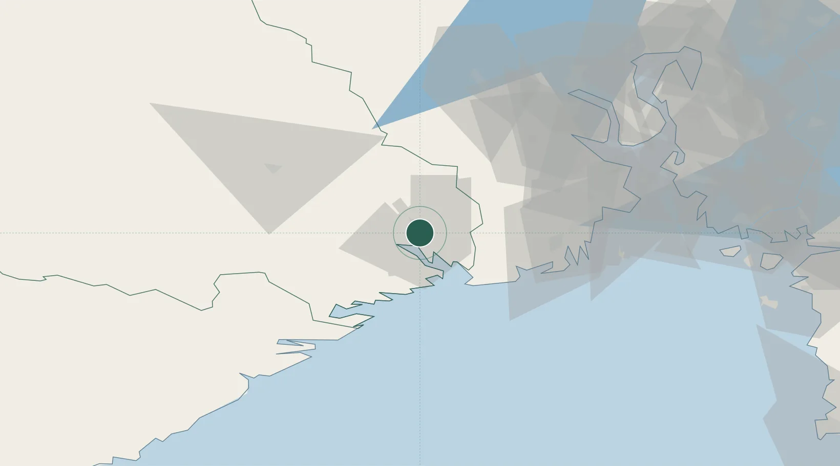
Nearby Logistics Neighbours

Cities
  1. 1Porsgrunn4 km
  2. 2Skien4 km
  3. 3Herøya6 km
  4. 4Herre8 km
  5. 5Rafnes8 km
Nearest neighbours — logibook spatial index (haversine) over the source coordinates
Ports
  1. 1Porsgrunn3 km
  2. 2Skien4 km
  3. 3Brevik12 km
  4. 4Larvik27 km
  5. 5Sandefjorden35 km
Nearest neighbours — logibook spatial index (haversine) over the source coordinates
Airports
  1. 1Skien Airport4 km
  2. 2Sandefjord Airport, Torp36 km
  3. 3Notodden Airport50 km
  4. 4Moss Airport, Rygge70 km
  5. 5Kristiansand Airport140 km
Nearest neighbours — logibook spatial index (haversine) over the source coordinates
Trade Zones
  1. 1Gothenburg Boundless Customs Warehouse206 km
  2. 2Jönköping Free Zone302 km
  3. 3Freeport of Copenhagen- Nordhavn423 km
  4. 4MTS Malmö Transport and Spedition447 km
  5. 5Freeport of Kiel538 km
Nearest neighbours — logibook spatial index (haversine) over the source coordinates
DatabookThe Record of Consolidated Knowledge
Norway beyond logistics?
Browse databook

All Sources

LocationsUN/LOCODE
UN/LOCODE — free
Portsthe NGA World Port Index
Public domain (US gov)
AirportsOurAirports
Public domain
Trade Zonesthe World Bank SEZ database
CC BY 4.0
Trade ZonesOpen Zone Map
CC BY
← Norway locations