UN/LOCODE hub · Malaysia
MYTKP

Kampong Tanjong Kupang

1.3500°, 103.5833°
2
Transport functions

Transport Functions

Port
Road
UN/LOCODE

Hub Profile

Region
01
GeoNames

Location

Location of MYTKP
Natural Earth 10m (public domain) · 01 · MYTKP · 1.35, 103.58GoogleOSMYandex

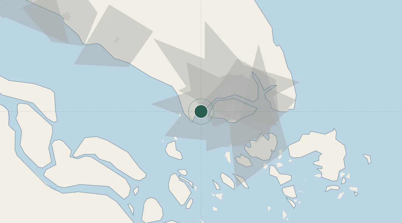
Nearby Logistics Neighbours

Cities
  1. 1Gelang Patah4 km
  2. 2Tanjung Pelepas4 km
  3. 3Tanjong Bin4 km
  4. 4Tuas8 km
  5. 5Singapore15 km
Nearest neighbours — logibook spatial index (haversine) over the source coordinates
Ports
  1. 1Tanjung Pelepas4 km
  2. 2Jurong Island18 km
  3. 3Pulau Bukom24 km
  4. 4Pulau Sebarok29 km
  5. 5Keppel - (East Singapore)31 km
Nearest neighbours — logibook spatial index (haversine) over the source coordinates
Airports
  1. 1Tengah Air Base15 km
  2. 2Sembawang Air Base27 km
  3. 3Seletar Airport32 km
  4. 4Senai International Airport34 km
  5. 5Paya Lebar Air Base36 km
Nearest neighbours — logibook spatial index (haversine) over the source coordinates
Trade Zones
  1. 1Port Of Tanjung Pelepas Free Zone4 km
  2. 2Western Gate Development Flagship Zone5 km
  3. 3Tanjung Bin Free Industrial Zone, Johor5 km
  4. 4Nusajaya Flagship Zone8 km
  5. 5Jurong Innovation District12 km
Nearest neighbours — logibook spatial index (haversine) over the source coordinates
DatabookThe Record of Consolidated Knowledge
Malaysia beyond logistics?
Browse databook

All Sources

LocationsUN/LOCODE
UN/LOCODE — free
Portsthe NGA World Port Index
Public domain (US gov)
AirportsOurAirports
Public domain
Trade Zonesthe World Bank SEZ database
CC BY 4.0
Trade ZonesOpen Zone Map
CC BY
← Malaysia locations