UN/LOCODE hub · South Korea
KRSGG

Songgong

34.8333°, 126.2167°
1
Transport functions

Transport Functions

Port
UN/LOCODE

Hub Profile

Region
46
GeoNames

Location

Location of KRSGG
Natural Earth 10m (public domain) · 46 · KRSGG · 34.83, 126.22GoogleOSMYandex

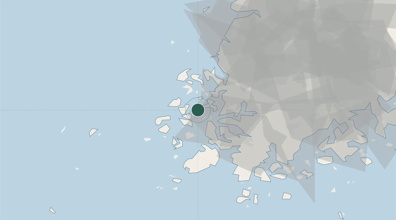
Nearby Logistics Neighbours

Cities
  1. 1Sinan-gun15 km
  2. 2Mokpo16 km
  3. 3Daebul/Yeongam-gun22 km
  4. 4Jindo-gun39 km
  5. 5Yeongam-gun45 km
Nearest neighbours — logibook spatial index (haversine) over the source coordinates
Ports
  1. 1Mokpo16 km
  2. 2Kunsan133 km
  3. 3Gwangyang Hang140 km
  4. 4Masan218 km
  5. 5Chinae224 km
Nearest neighbours — logibook spatial index (haversine) over the source coordinates
Airports
  1. 1Muan International Airport23 km
  2. 2Gwangju Airport63 km
  3. 3Gunsan Airport / Gunsan Air Base124 km
  4. 4Yeosu Airport128 km
  5. 5Jeju International Airport149 km
Nearest neighbours — logibook spatial index (haversine) over the source coordinates
Trade Zones
  1. 1Samho General Industrial Complex18 km
  2. 2Daebul Foreign Investment Zone22 km
  3. 3Daebul Foreign Investment Zone22 km
  4. 4South Jeolla Regulation-Free Zone40 km
  5. 5Jindo Export Processing Zone42 km
Nearest neighbours — logibook spatial index (haversine) over the source coordinates
DatabookThe Record of Consolidated Knowledge
South Korea beyond logistics?
Browse databook

All Sources

LocationsUN/LOCODE
UN/LOCODE — free
Portsthe NGA World Port Index
Public domain (US gov)
AirportsOurAirports
Public domain
Trade Zonesthe World Bank SEZ database
CC BY 4.0
Trade ZonesOpen Zone Map
CC BY
← South Korea locations