UN/LOCODE hub · South Korea
KRDBL

Daebul/Yeongam-gun

34.7500°, 126.4333°
3
Transport functions

Transport Functions

Port
Rail
Road
UN/LOCODE

Hub Profile

Region
46
GeoNames

Location

Location of KRDBL
Natural Earth 10m (public domain) · 46 · KRDBL · 34.75, 126.43GoogleOSMYandex

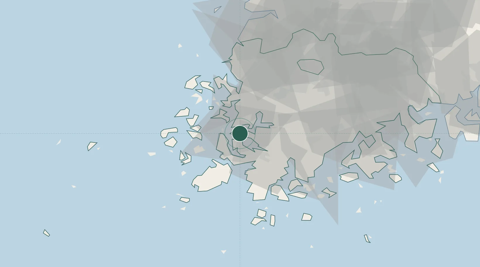
Nearby Logistics Neighbours

Cities
  1. 1Sinan-gun7 km
  2. 2Mokpo7 km
  3. 3Songgong22 km
  4. 4Yeongam-gun25 km
  5. 5Jindo-gun34 km
Nearest neighbours — logibook spatial index (haversine) over the source coordinates
Ports
  1. 1Mokpo6 km
  2. 2Gwangyang Hang122 km
  3. 3Kunsan138 km
  4. 4Masan200 km
  5. 5Chinae207 km
Nearest neighbours — logibook spatial index (haversine) over the source coordinates
Airports
  1. 1Muan International Airport27 km
  2. 2Gwangju Airport54 km
  3. 3Yeosu Airport109 km
  4. 4Gunsan Airport / Gunsan Air Base129 km
  5. 5Jeju International Airport138 km
Nearest neighbours — logibook spatial index (haversine) over the source coordinates
Trade Zones
  1. 1Daebul Foreign Investment Zone2 km
  2. 2Daebul Foreign Investment Zone2 km
  3. 3Samho General Industrial Complex6 km
  4. 4Haenam Enterprise City of Tourism and Leisure25 km
  5. 5South Jeolla Regulation-Free Zone27 km
Nearest neighbours — logibook spatial index (haversine) over the source coordinates
DatabookThe Record of Consolidated Knowledge
South Korea beyond logistics?
Browse databook

All Sources

LocationsUN/LOCODE
UN/LOCODE — free
Portsthe NGA World Port Index
Public domain (US gov)
AirportsOurAirports
Public domain
Trade Zonesthe World Bank SEZ database
CC BY 4.0
Trade ZonesOpen Zone Map
CC BY
← South Korea locations