UN/LOCODE hub · South Korea
KRNHE

Namhae-gun

34.8333°, 127.8833°
2
Transport functions

Transport Functions

Rail
Road
UN/LOCODE

Hub Profile

Region
48
GeoNames

Location

Location of KRNHE
Natural Earth 10m (public domain) · 48 · KRNHE · 34.83, 127.88GoogleOSMYandex

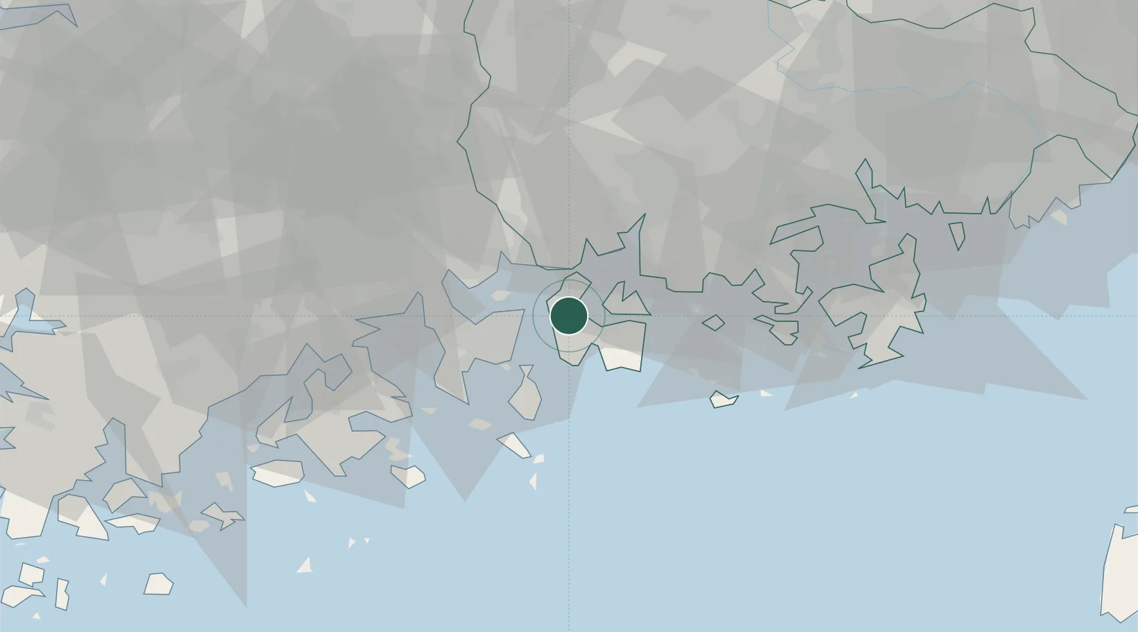
Nearby Logistics Neighbours

Cities
  1. 1Boseong-gun11 km
  2. 2Sangam-dong14 km
  3. 3Yeosu18 km
  4. 4Samcheonpo/Sacheon19 km
  5. 5Gwangyang21 km
Nearest neighbours — logibook spatial index (haversine) over the source coordinates
Ports
  1. 1Gwangyang Hang15 km
  2. 2Masan73 km
  3. 3Chinae77 km
  4. 4Busan109 km
  5. 5Mokpo137 km
Nearest neighbours — logibook spatial index (haversine) over the source coordinates
Airports
  1. 1Yeosu Airport24 km
  2. 2Sacheon Airport / Sacheon Air Base33 km
  3. 3Gwangju Airport103 km
  4. 4Gimhae International Airport104 km
  5. 5Daegu International Airport137 km
Nearest neighbours — logibook spatial index (haversine) over the source coordinates
Trade Zones
  1. 1Daesong Industrial Complex15 km
  2. 2Yeosu National Industrial Complex19 km
  3. 3Hwanggeum Industrial Complex23 km
  4. 4Yulchon 1 General Industrial Complex28 km
  5. 5Gwangyang Bay Area Free Economic Zone28 km
Nearest neighbours — logibook spatial index (haversine) over the source coordinates
DatabookThe Record of Consolidated Knowledge
South Korea beyond logistics?
Browse databook

All Sources

LocationsUN/LOCODE
UN/LOCODE — free
Portsthe NGA World Port Index
Public domain (US gov)
AirportsOurAirports
Public domain
Trade Zonesthe World Bank SEZ database
CC BY 4.0
Trade ZonesOpen Zone Map
CC BY
← South Korea locations