UN/LOCODE hub · South Korea
KRBSG

Boseong-gun

34.7667°, 127.8000°
2
Transport functions

Transport Functions

Rail
Road
UN/LOCODE

Hub Profile

Region
46
GeoNames

Location

Location of KRBSG
Natural Earth 10m (public domain) · 46 · KRBSG · 34.77, 127.80GoogleOSMYandex

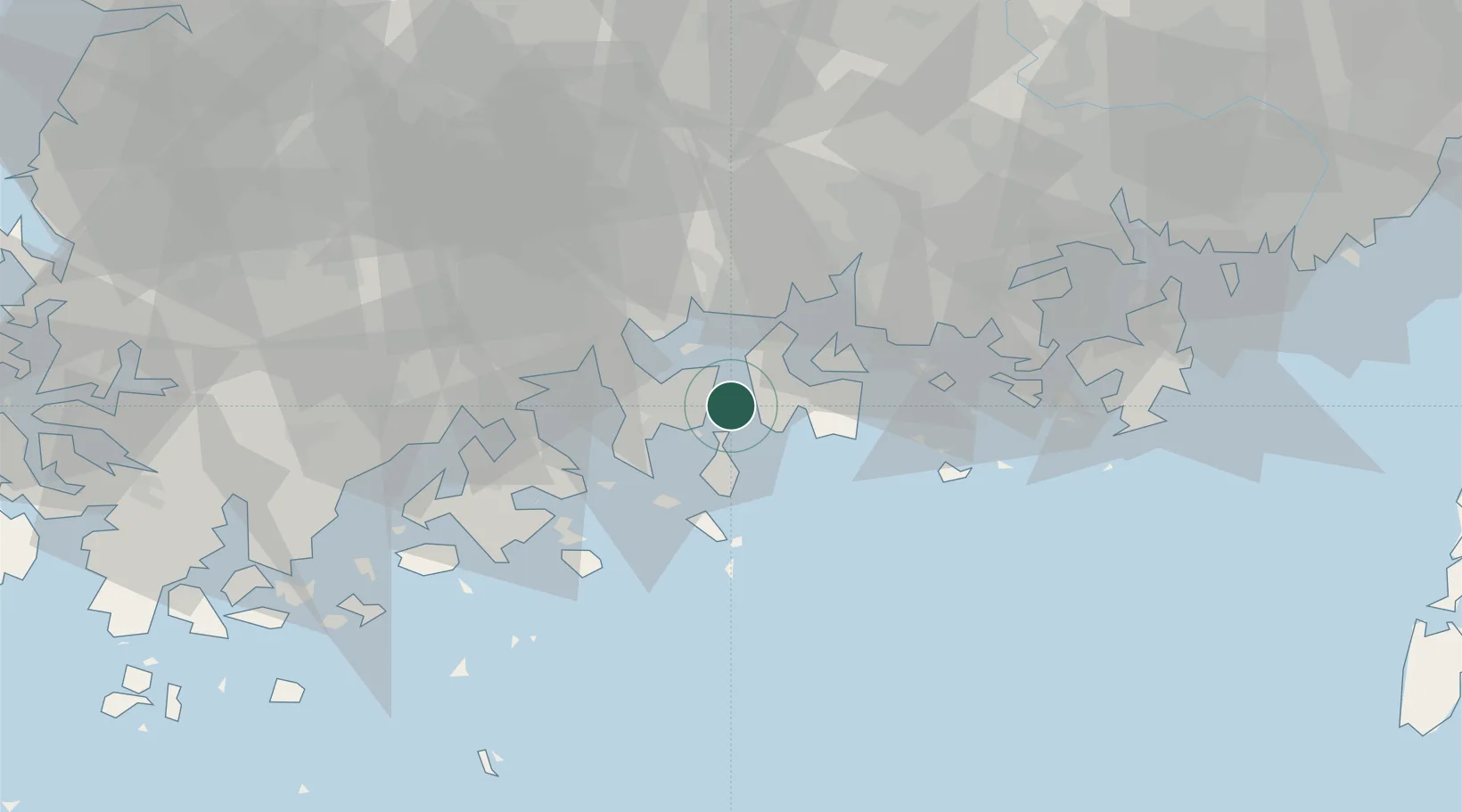
Nearby Logistics Neighbours

Cities
  1. 1Yeosu8 km
  2. 2Sangam-dong8 km
  3. 3Namhae-gun11 km
  4. 4Gwangyang20 km
  5. 5Samcheonpo/Sacheon30 km
Nearest neighbours — logibook spatial index (haversine) over the source coordinates
Ports
  1. 1Gwangyang Hang16 km
  2. 2Masan84 km
  3. 3Chinae88 km
  4. 4Busan118 km
  5. 5Mokpo129 km
Nearest neighbours — logibook spatial index (haversine) over the source coordinates
Airports
  1. 1Yeosu Airport19 km
  2. 2Sacheon Airport / Sacheon Air Base44 km
  3. 3Gwangju Airport99 km
  4. 4Gimhae International Airport113 km
  5. 5Muan International Airport132 km
Nearest neighbours — logibook spatial index (haversine) over the source coordinates
Trade Zones
  1. 1Yeosu National Industrial Complex14 km
  2. 2Hwanggeum Industrial Complex21 km
  3. 3Daesong Industrial Complex22 km
  4. 4Yulchon 1 General Industrial Complex24 km
  5. 5Haeryong Industrial Complex25 km
Nearest neighbours — logibook spatial index (haversine) over the source coordinates
DatabookThe Record of Consolidated Knowledge
South Korea beyond logistics?
Browse databook

All Sources

LocationsUN/LOCODE
UN/LOCODE — free
Portsthe NGA World Port Index
Public domain (US gov)
AirportsOurAirports
Public domain
Trade Zonesthe World Bank SEZ database
CC BY 4.0
Trade ZonesOpen Zone Map
CC BY
← South Korea locations