UN/LOCODE hub · Iran
IRSRP

Shahid Rajaee Pt/Bandar Abbas

27.1167°, 56.0667°
1
Transport functions

Transport Functions

Port
UN/LOCODE

Hub Profile

Region
23
GeoNames

Location

Location of IRSRP
Natural Earth 10m (public domain) · 23 · IRSRP · 27.12, 56.07GoogleOSMYandex

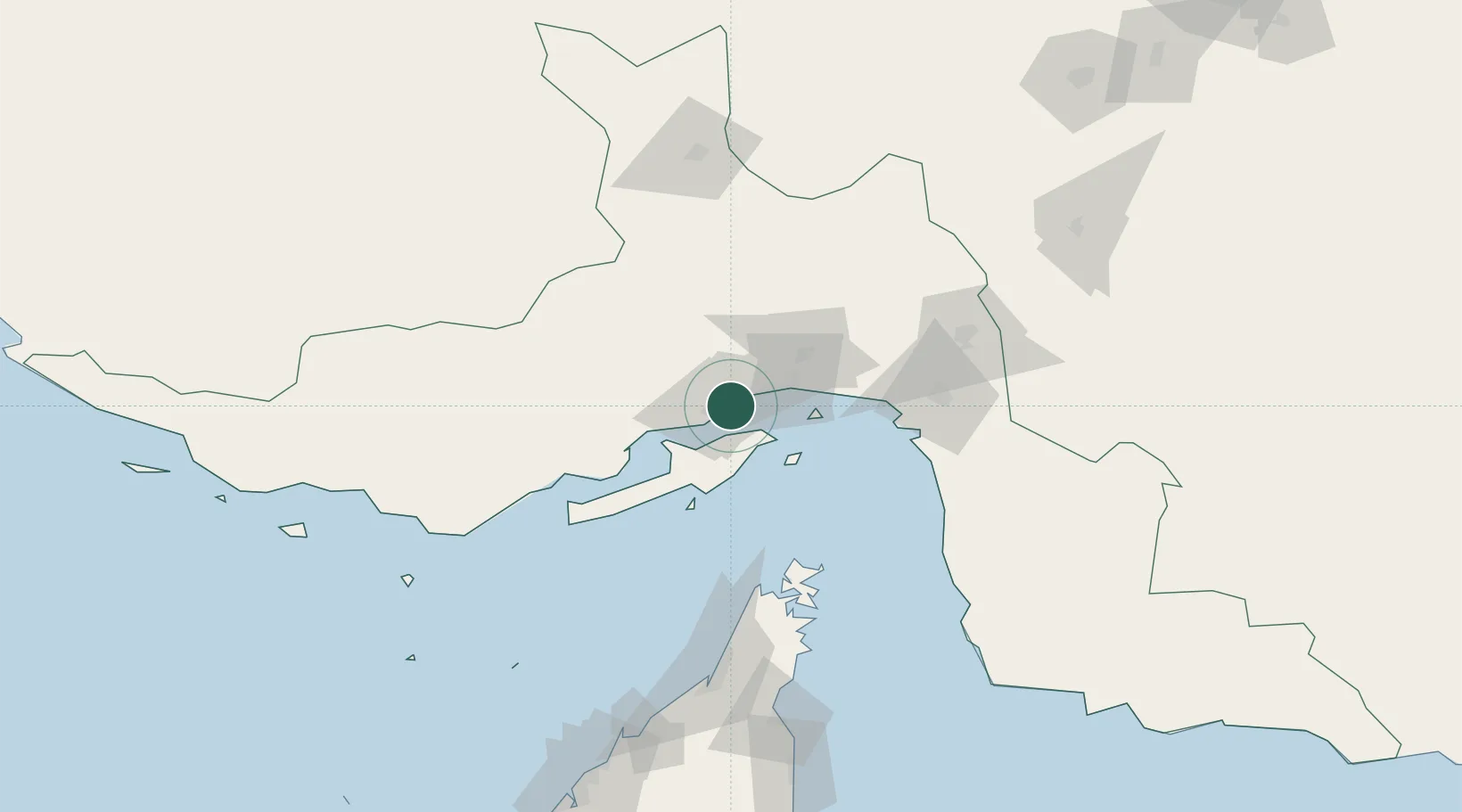
Nearby Logistics Neighbours

Cities
  1. 1Bandar Abbas7 km
  2. 2Shahid Bahonar13 km
  3. 3Kuvei20 km
  4. 4Quoin Island74 km
  5. 5Al Jeer Port121 km
Nearest neighbours — logibook spatial index (haversine) over the source coordinates
Ports
  1. 1Bandar-E Shahid Rejaie2 km
  2. 2Bandar Abbas14 km
  3. 3Jazireh-Ye Hormoz38 km
  4. 4Khawr Khasab101 km
  5. 5Mina Saqr126 km
Nearest neighbours — logibook spatial index (haversine) over the source coordinates
Airports
  1. 1Bandar Abbas International Airport33 km
  2. 2Qeshm International Airport43 km
  3. 3Khasab Airport107 km
  4. 4Oghab 44 Airbase117 km
  5. 5Bandar Lengeh International Airport139 km
Nearest neighbours — logibook spatial index (haversine) over the source coordinates
Trade Zones
  1. 1Shahid Rajaei Saheed Rajaee Port1 km
  2. 2Special Economic Zone of the Persian Gulf Mining and Metal Industries4 km
  3. 3Qeshm Free Trade - Industrial Zone27 km
  4. 4RAK Maritime City Free Zone131 km
  5. 5RAKEZ Academic Zone154 km
Nearest neighbours — logibook spatial index (haversine) over the source coordinates
DatabookThe Record of Consolidated Knowledge
Iran beyond logistics?
Browse databook

All Sources

LocationsUN/LOCODE
UN/LOCODE — free
Portsthe NGA World Port Index
Public domain (US gov)
AirportsOurAirports
Public domain
Trade Zonesthe World Bank SEZ database
CC BY 4.0
Trade ZonesOpen Zone Map
CC BY
← Iran locations