UN/LOCODE hub · India
INVGR

Bhojva Icd/Viramgam

23.1167°, 72.0500°
1
Transport functions

Transport Functions

Multimodal
UN/LOCODE

Hub Profile

Region
GJ
GeoNames

Location

Location of INVGR
Natural Earth 10m (public domain) · GJ · INVGR · 23.12, 72.05GoogleOSMYandex

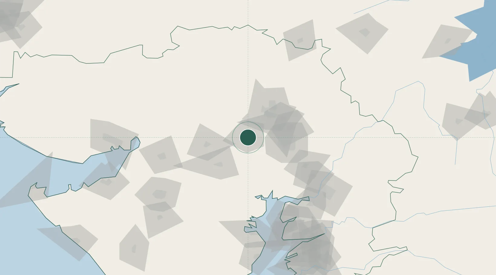
Nearby Logistics Neighbours

Cities
  1. 1Sachana ICD/Viramgam13 km
  2. 2Kalol48 km
  3. 3Ahmedabad50 km
  4. 4Ccipl-SEZ/Ahmadabad59 km
  5. 5Gipl-SEZ/Ahmadabad59 km
Nearest neighbours — logibook spatial index (haversine) over the source coordinates
Ports
  1. 1Bhavnagar151 km
  2. 2Navlakhi165 km
  3. 3Dahej165 km
  4. 4Kandla188 km
  5. 5Bedi214 km
Nearest neighbours — logibook spatial index (haversine) over the source coordinates
Airports
  1. 1Sardar Vallabh Patel International Airport60 km
  2. 2Rajkot International Airport132 km
  3. 3Vadodara International Airport149 km
  4. 4Bhavnagar Airport152 km
  5. 5Rajkot Airport158 km
Nearest neighbours — logibook spatial index (haversine) over the source coordinates
Trade Zones
  1. 1Zydus Infrastructure Pvt.Ltd.45 km
  2. 2OPGS Power Gujarat Pvt.48 km
  3. 3Suzlon Infrastructure Ltd.53 km
  4. 4GiDC Apparel Park Ahmedabad59 km
  5. 5Tata Consultancy Services Ltd, Gandhinagar.60 km
Nearest neighbours — logibook spatial index (haversine) over the source coordinates
DatabookThe Record of Consolidated Knowledge
India beyond logistics?
Browse databook

All Sources

LocationsUN/LOCODE
UN/LOCODE — free
Portsthe NGA World Port Index
Public domain (US gov)
AirportsOurAirports
Public domain
Trade Zonesthe World Bank SEZ database
CC BY 4.0
Trade ZonesOpen Zone Map
CC BY
← India locations