UN/LOCODE hub · India
INSMK

Shimoga

13.9167°, 75.5667°
1
Transport functions

Transport Functions

Multimodal
UN/LOCODE

Hub Profile

Region
KA
GeoNames

Location

Location of INSMK
Natural Earth 10m (public domain) · KA · INSMK · 13.92, 75.57GoogleOSMYandex

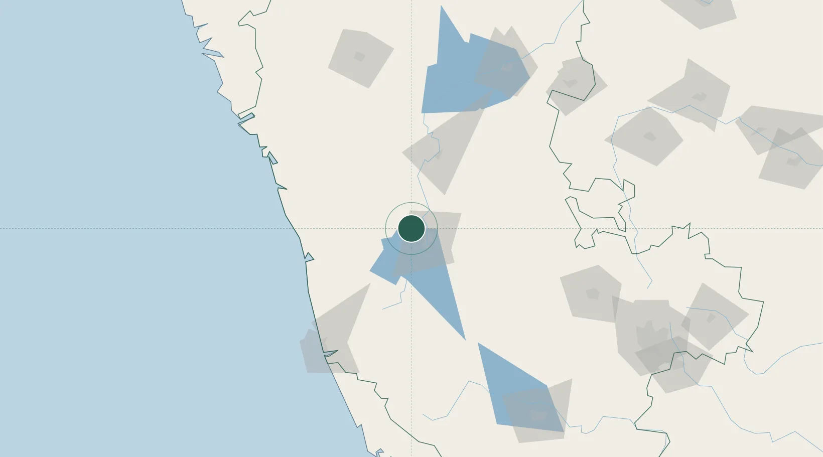
Nearby Logistics Neighbours

Cities
  1. 1Kanara62 km
  2. 2Synefra-SEZ/Udupi108 km
  3. 3Hassan116 km
  4. 4OPTO INFRA SEZ/Hassan116 km
  5. 5Kiadbfp-SEZ/Hassan116 km
Nearest neighbours — logibook spatial index (haversine) over the source coordinates
Ports
  1. 1New Mangalore138 km
  2. 2Belekeri165 km
  3. 3Karwar186 km
  4. 4Azhikal (Azhikkal)221 km
  5. 5Marmagao253 km
Nearest neighbours — logibook spatial index (haversine) over the source coordinates
Airports
  1. 1Rashtrakavi Kuvempu Airport9 km
  2. 2Mangaluru International Airport130 km
  3. 3Hubballi Airport169 km
  4. 4Bellary Airport198 km
  5. 5Mysore Airport222 km
Nearest neighbours — logibook spatial index (haversine) over the source coordinates
Trade Zones
  1. 1Keonics Shimoga9 km
  2. 2Kiadb Food Processing Special Economic Zone117 km
  3. 3Suzlon Infrastructure Ltd.121 km
  4. 4Kiadb SEZ Hassan - Textiles122 km
  5. 5Aspen, Padubidri Special Economic Zone (Formerly Aspen)122 km
Nearest neighbours — logibook spatial index (haversine) over the source coordinates
DatabookThe Record of Consolidated Knowledge
India beyond logistics?
Browse databook

All Sources

LocationsUN/LOCODE
UN/LOCODE — free
Portsthe NGA World Port Index
Public domain (US gov)
AirportsOurAirports
Public domain
Trade Zonesthe World Bank SEZ database
CC BY 4.0
Trade ZonesOpen Zone Map
CC BY
← India locations