UN/LOCODE hub · Greece
GRPIK

Pikérmion

38.0000°, 23.9500°
2
Transport functions

Transport Functions

Road
Multimodal
UN/LOCODE

Hub Profile

Region
A1
GeoNames

Location

Location of GRPIK
Natural Earth 10m (public domain) · A1 · GRPIK · 38.00, 23.95GoogleOSMYandex

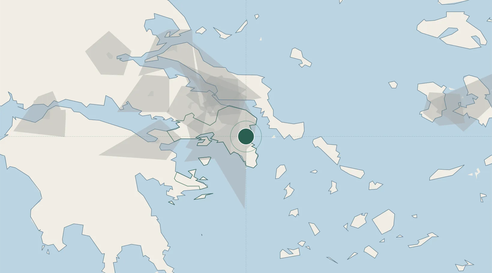
Nearby Logistics Neighbours

Cities
  1. 1Artemis6 km
  2. 2Markopoulo13 km
  3. 3Anargyroi21 km
  4. 4Acharnes21 km
  5. 5Akharnaí21 km
Nearest neighbours — logibook spatial index (haversine) over the source coordinates
Ports
  1. 1Piraievs27 km
  2. 2Lavrio35 km
  3. 3Ormos Aliveriou44 km
  4. 4Megara Oil Terminal48 km
  5. 5Gavrio70 km
Nearest neighbours — logibook spatial index (haversine) over the source coordinates
Airports
  1. 1Athens Eleftherios Venizelos International Airport7 km
  2. 2Elefsis Air Base35 km
  3. 3Tanagra Air Base51 km
  4. 4Syros Airport109 km
  5. 5Skiros Airport117 km
Nearest neighbours — logibook spatial index (haversine) over the source coordinates
Trade Zones
  1. 1Free Zone of Piraeus30 km
  2. 2Free Zone of Platigiali (Astakos Etoloakarnanias)254 km
  3. 3Free Zone of Thessaloniki306 km
  4. 4TIDZ Gevgelija377 km
  5. 5TIDZ Strumica392 km
Nearest neighbours — logibook spatial index (haversine) over the source coordinates
DatabookThe Record of Consolidated Knowledge
Greece beyond logistics?
Browse databook

All Sources

LocationsUN/LOCODE
UN/LOCODE — free
Portsthe NGA World Port Index
Public domain (US gov)
AirportsOurAirports
Public domain
Trade Zonesthe World Bank SEZ database
CC BY 4.0
Trade ZonesOpen Zone Map
CC BY
← Greece locations