UN/LOCODE hub · Greece
GROIN

Oinófita

38.3157°, 23.6193°
2
Transport functions

Transport Functions

Rail
Road
UN/LOCODE

Hub Profile

Region
03
GeoNames
Logistics facilities
1
UN/LOCODE

Location

Location of GROIN
Natural Earth 10m (public domain) · 03 · GROIN · 38.32, 23.62GoogleOSMYandex

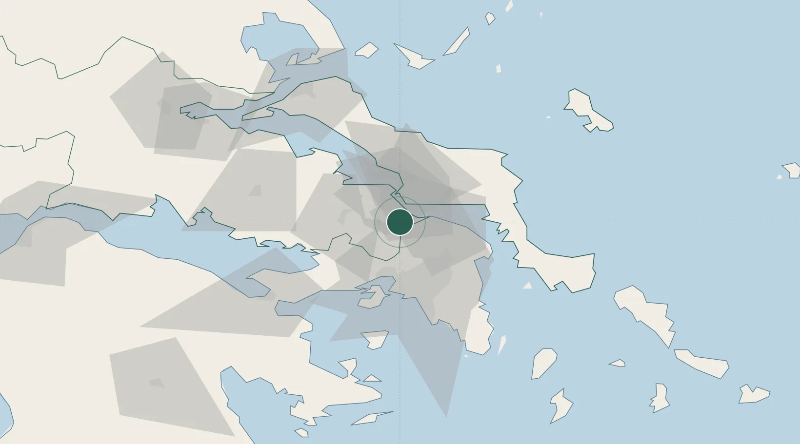
Nearby Logistics Neighbours

Cities
  1. 1Schimatarion3 km
  2. 2Avlida10 km
  3. 3Vathi10 km
  4. 4Lefkandi13 km
  5. 5Oropos14 km
Nearest neighbours — logibook spatial index (haversine) over the source coordinates
Ports
  1. 1Ormos Aliveriou38 km
  2. 2Piraievs43 km
  3. 3Megara Oil Terminal43 km
  4. 4Kymassi59 km
  5. 5Lavrio79 km
Nearest neighbours — logibook spatial index (haversine) over the source coordinates
Airports
  1. 1Tanagra Air Base5 km
  2. 2Elefsis Air Base29 km
  3. 3Athens Eleftherios Venizelos International Airport51 km
  4. 4Skiathos Island National Airport96 km
  5. 5Skiros Airport105 km
Nearest neighbours — logibook spatial index (haversine) over the source coordinates
Trade Zones
  1. 1Free Zone of Piraeus41 km
  2. 2Free Zone of Platigiali (Astakos Etoloakarnanias)220 km
  3. 3Free Zone of Thessaloniki265 km
  4. 4TIDZ Gevgelija335 km
  5. 5TIDZ Strumica351 km
Nearest neighbours — logibook spatial index (haversine) over the source coordinates
DatabookThe Record of Consolidated Knowledge
Greece beyond logistics?
Browse databook

All Sources

LocationsUN/LOCODE
UN/LOCODE — free
Portsthe NGA World Port Index
Public domain (US gov)
AirportsOurAirports
Public domain
Trade Zonesthe World Bank SEZ database
CC BY 4.0
Trade ZonesOpen Zone Map
CC BY
← Greece locations