UN/LOCODE hub · Greece
GROIK

Oia Kyklades

36.4667°, 25.3833°
1
Transport functions

Transport Functions

Port
UN/LOCODE

Hub Profile

Region
82
GeoNames

Location

Location of GROIK
Natural Earth 10m (public domain) · 82 · GROIK · 36.47, 25.38GoogleOSMYandex

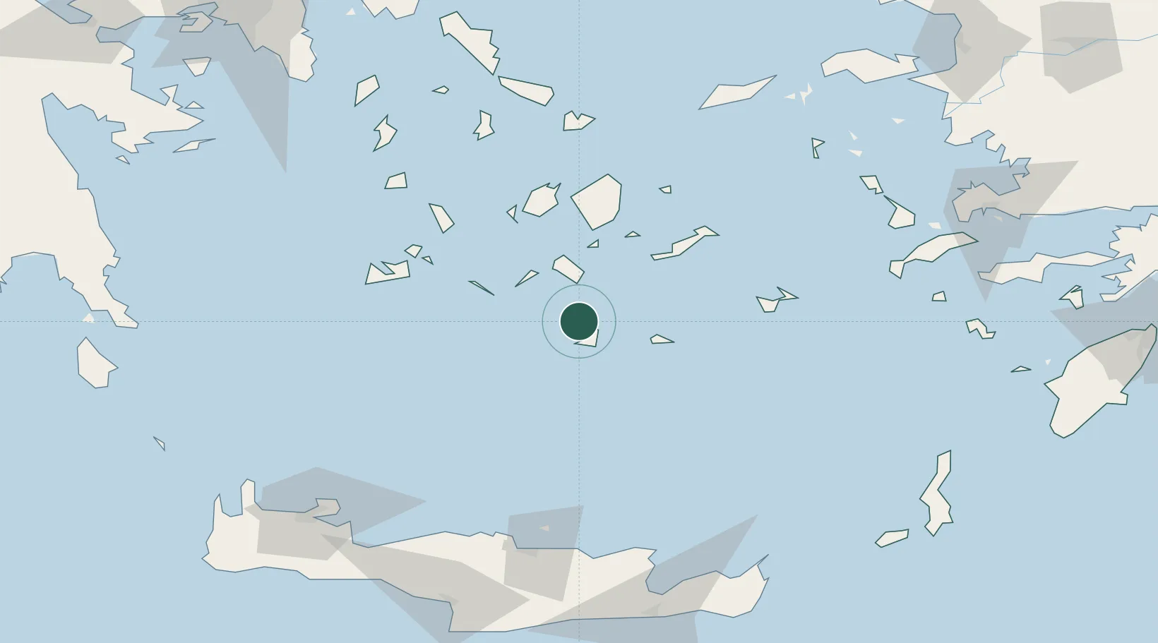
Nearby Logistics Neighbours

Cities
  1. 1Thirasía5 km
  2. 2Thíra7 km
  3. 3Athinios Thira Santorini10 km
  4. 4Ios30 km
  5. 5Sikinos35 km
Nearest neighbours — logibook spatial index (haversine) over the source coordinates
Ports
  1. 1Nisos Naxos70 km
  2. 2Milos88 km
  3. 3Mikonos109 km
  4. 4Limin Sirou114 km
  5. 5Iraklion126 km
Nearest neighbours — logibook spatial index (haversine) over the source coordinates
Airports
  1. 1Santorini International Airport11 km
  2. 2Paros National Airport66 km
  3. 3Naxos Island National Airport68 km
  4. 4Milos Airport85 km
  5. 5Astypalaia Airport90 km
Nearest neighbours — logibook spatial index (haversine) over the source coordinates
Trade Zones
  1. 1Free Zone of Heraklion143 km
  2. 2Free Zone of Piraeus227 km
  3. 3Aegean Free Zone259 km
  4. 4Izmir Ataturk Organized Industrial Zone268 km
  5. 5Izmir Free Zone275 km
Nearest neighbours — logibook spatial index (haversine) over the source coordinates
DatabookThe Record of Consolidated Knowledge
Greece beyond logistics?
Browse databook

All Sources

LocationsUN/LOCODE
UN/LOCODE — free
Portsthe NGA World Port Index
Public domain (US gov)
AirportsOurAirports
Public domain
Trade Zonesthe World Bank SEZ database
CC BY 4.0
Trade ZonesOpen Zone Map
CC BY
← Greece locations