UN/LOCODE hub · Greece
GRLTR

Loutro Chanion

35.2000°, 24.0833°
1
Transport functions

Transport Functions

Port
UN/LOCODE

Location

Location of GRLTR
Natural Earth 10m (public domain) · Kriti · GRLTR · 35.20, 24.08GoogleOSMYandex

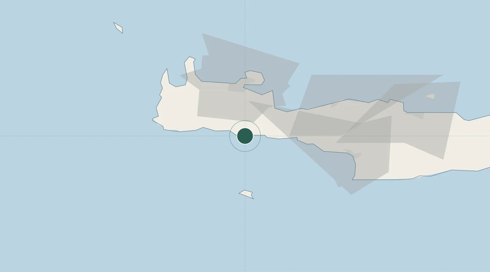
Nearby Logistics Neighbours

Cities
  1. 1Khóra Sfakíon5 km
  2. 2Paleohora Sfakion5 km
  3. 3Agia Roumeli11 km
  4. 4Sougia Chanion26 km
  5. 5Plakias27 km
Nearest neighbours — logibook spatial index (haversine) over the source coordinates
Ports
  1. 1Soudha33 km
  2. 2Rethimnon39 km
  3. 3Kali Limenes74 km
  4. 4Iraklion98 km
  5. 5Ayios Nikolaos148 km
Nearest neighbours — logibook spatial index (haversine) over the source coordinates
Airports
  1. 1Chania International Airport37 km
  2. 2Heraklion International Nikos Kazantzakis Airport101 km
  3. 3(Duplicate)Kasteli Hellenic Air Force Base113 km
  4. 4Kithira Airport153 km
  5. 5Milos Airport170 km
Nearest neighbours — logibook spatial index (haversine) over the source coordinates
Trade Zones
  1. 1Free Zone of Heraklion91 km
  2. 2Free Zone of Piraeus308 km
  3. 3Tobruk Free Zone352 km
  4. 4Aegean Free Zone442 km
  5. 5Izmir Ataturk Organized Industrial Zone451 km
Nearest neighbours — logibook spatial index (haversine) over the source coordinates
DatabookThe Record of Consolidated Knowledge
Greece beyond logistics?
Browse databook

All Sources

LocationsUN/LOCODE
UN/LOCODE — free
Portsthe NGA World Port Index
Public domain (US gov)
AirportsOurAirports
Public domain
Trade Zonesthe World Bank SEZ database
CC BY 4.0
Trade ZonesOpen Zone Map
CC BY
← Greece locations