UN/LOCODE hub · Greece
GRJSI

Skíathos

39.1667°, 23.4833°
5,187
Population
2
Transport functions

Transport Functions

Port
Airport
UN/LOCODE

Hub Profile

Place type
Populated place
GeoNames
Region
Thessaly
GeoNames
Population
5,187
GeoNames
Time zone
Europe/Athens
GeoNames
Elevation
4 m
GeoNames

Location

Location of GRJSI
Natural Earth 10m (public domain) · Thessaly · GRJSI · 39.17, 23.48GoogleOSMYandex

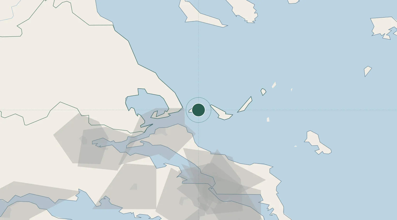
Nearby Logistics Neighbours

Cities
  1. 1Glossa12 km
  2. 2Klima15 km
  3. 3Platania19 km
  4. 4Agnontas Skopelos21 km
  5. 5Peyki Evvoias30 km
Nearest neighbours — logibook spatial index (haversine) over the source coordinates
Ports
  1. 1Kymassi37 km
  2. 2Volos51 km
  3. 3Tsingeli55 km
  4. 4Achladi65 km
  5. 5Ormos Aliveriou100 km
Nearest neighbours — logibook spatial index (haversine) over the source coordinates
Airports
  1. 1Skiathos Island National Airport2 km
  2. 2Nea Anchialos National Airport60 km
  3. 3Skiros Airport89 km
  4. 4Tanagra Air Base92 km
  5. 5Elefsis Air Base123 km
Nearest neighbours — logibook spatial index (haversine) over the source coordinates
Trade Zones
  1. 1Free Zone of Piraeus136 km
  2. 2Free Zone of Thessaloniki170 km
  3. 3Free Zone of Platigiali (Astakos Etoloakarnanias)220 km
  4. 4TIDZ Gevgelija241 km
  5. 5TIDZ Strumica256 km
Nearest neighbours — logibook spatial index (haversine) over the source coordinates
DatabookThe Record of Consolidated Knowledge
Greece beyond logistics?
Browse databook

All Sources

LocationsUN/LOCODE
UN/LOCODE — free
LocationsGeoNames
CC BY 4.0
Portsthe NGA World Port Index
Public domain (US gov)
AirportsOurAirports
Public domain
Trade Zonesthe World Bank SEZ database
CC BY 4.0
Trade ZonesOpen Zone Map
CC BY
← Greece locations