UN/LOCODE hub · Greece
GRGAV

Gávrion

37.8833°, 24.7333°
1
Transport functions

Transport Functions

Port
Gávrion is also a profiled seaport →
UN/LOCODE

Location

Location of GRGAV
Natural Earth 10m (public domain) · Notio Aigaio · GRGAV · 37.88, 24.73GoogleOSMYandex

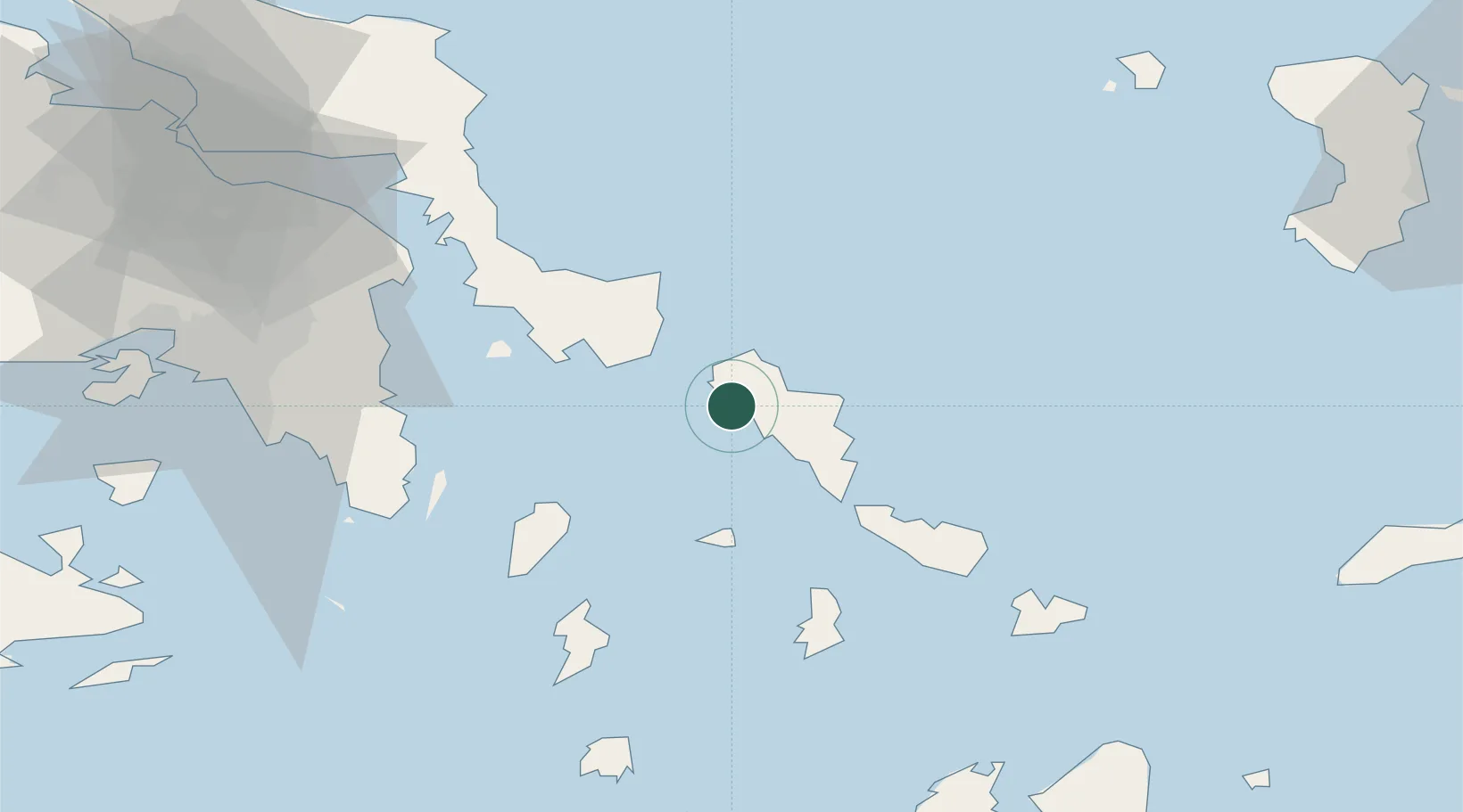
Nearby Logistics Neighbours

Cities
  1. 1Andros18 km
  2. 2Karystos32 km
  3. 3Órmos Panórmou38 km
  4. 4Marmari41 km
  5. 5Kéa (Tzia)45 km
Nearest neighbours — logibook spatial index (haversine) over the source coordinates
Ports
  1. 1Andros20 km
  2. 2Limin Sirou54 km
  3. 3Lavrio62 km
  4. 4Mikonos72 km
  5. 5Ormos Aliveriou82 km
Nearest neighbours — logibook spatial index (haversine) over the source coordinates
Airports
  1. 1Syros Airport55 km
  2. 2Athens Eleftherios Venizelos International Airport70 km
  3. 3Mykonos Island National Airport74 km
  4. 4Paros National Airport102 km
  5. 5Elefsis Air Base105 km
Nearest neighbours — logibook spatial index (haversine) over the source coordinates
Trade Zones
  1. 1Free Zone of Piraeus99 km
  2. 2Izmir Free Zone209 km
  3. 3Izmir Ataturk Organized Industrial Zone212 km
  4. 4Aegean Free Zone215 km
  5. 5Aliaga Kimya Ihtisas ve Karma Organized Industrial Zone228 km
Nearest neighbours — logibook spatial index (haversine) over the source coordinates
DatabookThe Record of Consolidated Knowledge
Greece beyond logistics?
Browse databook

All Sources

LocationsUN/LOCODE
UN/LOCODE — free
Portsthe NGA World Port Index
Public domain (US gov)
AirportsOurAirports
Public domain
Trade Zonesthe World Bank SEZ database
CC BY 4.0
Trade ZonesOpen Zone Map
CC BY
← Greece locations