About
Methodology
Sources
Licensing
English
EN
English
TR
Türkçe
DE
Deutsch
FR
Français
ES
Español
IT
Italiano
PT
Português
NL
Nederlands
PL
Polski
RU
Русский
UK
Українська
CS
Čeština
RO
Română
EL
Ελληνικά
BG
Български
AR
العربية
FA
فارسی
UR
اردو
HI
हिन्दी
BN
বাংলা
ID
Bahasa Indonesia
VI
Tiếng Việt
ZH
中文
JA
日本語
KO
한국어
logibook
/
Countries
/
Greece
/
Locations
/
Órmos Panórmou
UN/LOCODE hub ·
Greece
GR
PNT
Órmos Panórmou
37.6500°, 25.0500°
1
Transport functions
Transport Functions
Port
UN/LOCODE
Hub Profile
Place type
Populated place
GeoNames
Region
South Aegean
GeoNames
Time zone
Europe/Athens
GeoNames
Elevation
1 m
GeoNames
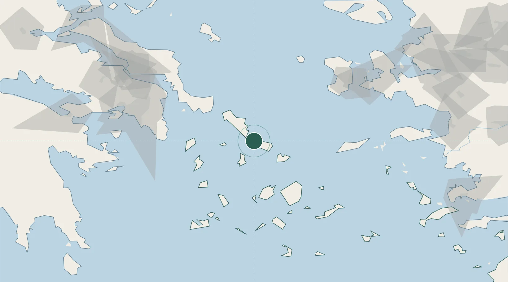
Location
Natural Earth 10m (public domain) · South Aegean · GRPNT · 37.65, 25.05
Google ↗
OSM ↗
Yandex ↗
Nearby Logistics Neighbours
Cities
1
Tínos
17 km
2
Andros
23 km
3
Mykonos
33 km
4
Delos
34 km
5
Gávrion
38 km
Nearest neighbours — logibook spatial index (haversine) over the source coordinates
Ports
1
Andros
22 km
2
Limin Sirou
26 km
3
Mikonos
33 km
4
Gavrio
38 km
5
Nisos Naxos
67 km
Nearest neighbours — logibook spatial index (haversine) over the source coordinates
Airports
1
Syros Airport
27 km
2
Mykonos Island National Airport
36 km
3
Naxos Island National Airport
69 km
4
Paros National Airport
70 km
5
Athens Eleftherios Venizelos International Airport
102 km
Nearest neighbours — logibook spatial index (haversine) over the source coordinates
Trade Zones
1
Free Zone of Piraeus
131 km
2
Izmir Free Zone
197 km
3
Aegean Free Zone
197 km
4
Izmir Ataturk Organized Industrial Zone
197 km
5
Aliaga Kimya Ihtisas ve Karma Organized Industrial Zone
218 km
Nearest neighbours — logibook spatial index (haversine) over the source coordinates
Data
book
The Record of Consolidated Knowledge
Greece beyond logistics?
Browse databook
→
All Sources
Locations
UN/LOCODE
UN/LOCODE — free
↗
Ports
the NGA World Port Index
Public domain (US gov)
↗
Airports
OurAirports
Public domain
↗
Trade Zones
the World Bank SEZ database
CC BY 4.0
↗
Trade Zones
Open Zone Map
CC BY
↗
← Greece locations