UN/LOCODE hub · Greece
GRFOL

Folégandros

36.6167°, 24.9500°
667
Population
1
Transport functions

Transport Functions

Port
UN/LOCODE

Hub Profile

Place type
District seat
GeoNames
Region
South Aegean
GeoNames
Population
667
GeoNames
Time zone
Europe/Athens
GeoNames
Elevation
206 m
GeoNames

Location

Location of GRFOL
Natural Earth 10m (public domain) · South Aegean · GRFOL · 36.62, 24.95GoogleOSMYandex

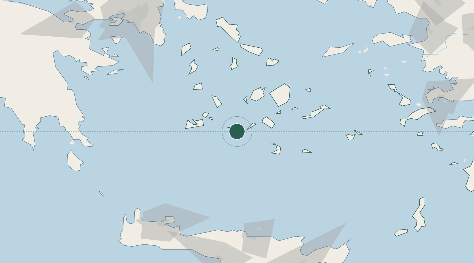
Nearby Logistics Neighbours

Cities
  1. 1Sikinos18 km
  2. 2Ios30 km
  3. 3Kímolos38 km
  4. 4Prassa Kimolos40 km
  5. 5Voudia Milos40 km
Nearest neighbours — logibook spatial index (haversine) over the source coordinates
Ports
  1. 1Milos46 km
  2. 2Nisos Naxos65 km
  3. 3Limin Sirou91 km
  4. 4Mikonos99 km
  5. 5Andros135 km
Nearest neighbours — logibook spatial index (haversine) over the source coordinates
Airports
  1. 1Milos Airport43 km
  2. 2Paros National Airport47 km
  3. 3Santorini International Airport53 km
  4. 4Naxos Island National Airport64 km
  5. 5Syros Airport90 km
Nearest neighbours — logibook spatial index (haversine) over the source coordinates
Trade Zones
  1. 1Free Zone of Heraklion158 km
  2. 2Free Zone of Piraeus189 km
  3. 3Aegean Free Zone271 km
  4. 4Izmir Ataturk Organized Industrial Zone278 km
  5. 5Izmir Free Zone283 km
Nearest neighbours — logibook spatial index (haversine) over the source coordinates
DatabookThe Record of Consolidated Knowledge
Greece beyond logistics?
Browse databook

All Sources

LocationsUN/LOCODE
UN/LOCODE — free
LocationsGeoNames
CC BY 4.0
Portsthe NGA World Port Index
Public domain (US gov)
AirportsOurAirports
Public domain
Trade Zonesthe World Bank SEZ database
CC BY 4.0
Trade ZonesOpen Zone Map
CC BY
← Greece locations