UN/LOCODE hub · France
FRPS5

Plassac

45.4667°, -0.5667°
412
Population
1
Transport functions

Transport Functions

Multimodal
UN/LOCODE

Hub Profile

Place type
Populated place
GeoNames
Region
Nouvelle-Aquitaine
GeoNames
Population
412
GeoNames
Time zone
Europe/Paris
GeoNames
Elevation
37 m
GeoNames

Location

Location of FRPS5
Natural Earth 10m (public domain) · Nouvelle-Aquitaine · FRPS5 · 45.47, -0.57GoogleOSMYandex

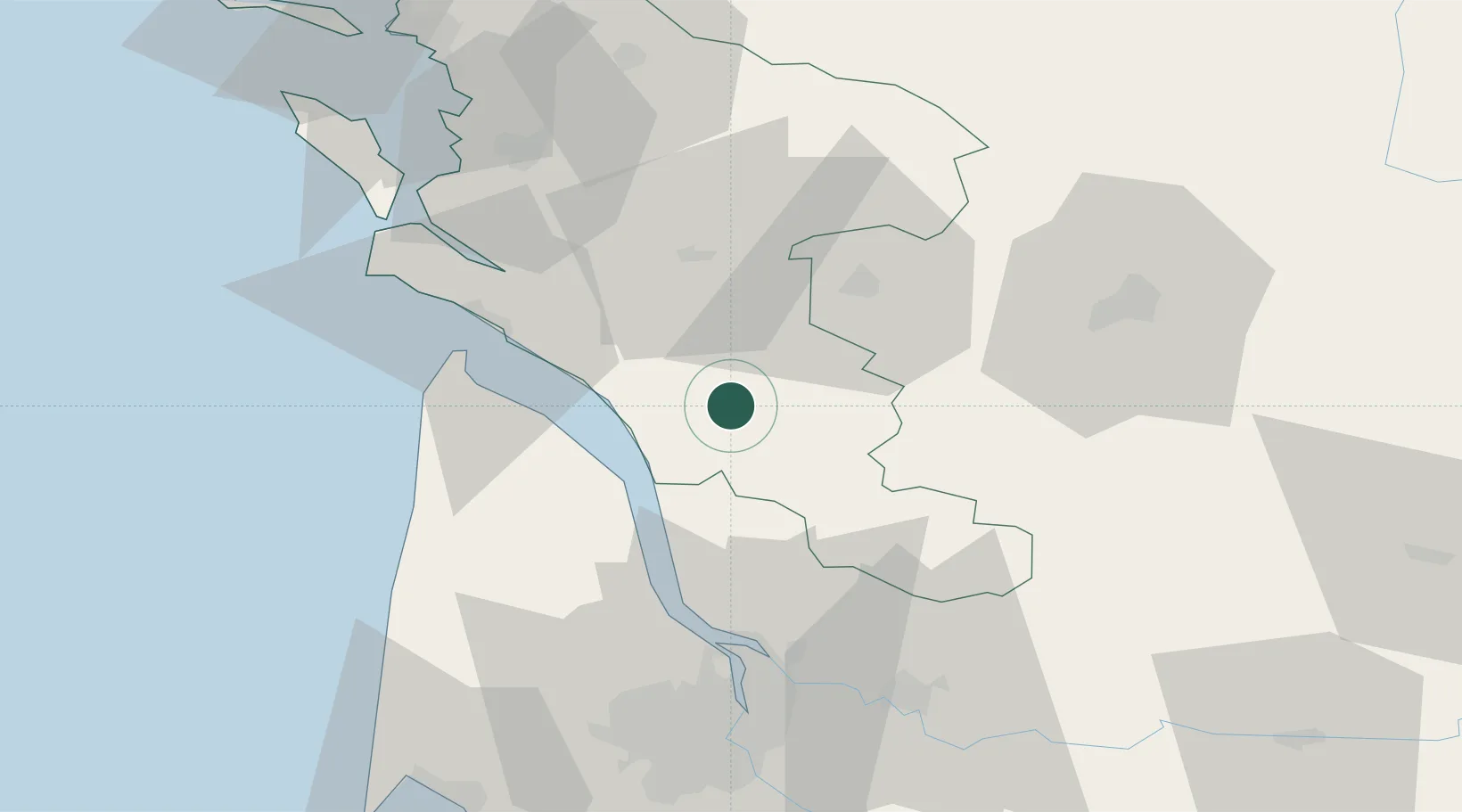
Nearby Logistics Neighbours

Cities
  1. 1Saint-Genis-de-Saintonge2 km
  2. 2Saint-Palais-de-Phiolin6 km
  3. 3Saint-Grégoire-d'Ardennes6 km
  4. 4Champagnolles8 km
  5. 5Marignac9 km
Nearest neighbours — logibook spatial index (haversine) over the source coordinates
Ports
  1. 1Pauillac33 km
  2. 2Blaye38 km
  3. 3Le Verdon39 km
  4. 4Ambes50 km
  5. 5Tonnay Charente58 km
Nearest neighbours — logibook spatial index (haversine) over the source coordinates
Airports
  1. 1Cognac-Châteaubernard (BA 709) Air Base29 km
  2. 2Royan-Médis Airport36 km
  3. 3Rochefort-Saint-Agnant (BA 721) Airport57 km
  4. 4Angoulême Brie-Champniers airport68 km
  5. 5Bordeaux–Mérignac Airport72 km
Nearest neighbours — logibook spatial index (haversine) over the source coordinates
Trade Zones
  1. 1Port de Bordeaux62 km
  2. 2ZFU Hauts de Garonne71 km
  3. 3ZFU La Rochelle92 km
  4. 4ZFU Nantes et Saint-Herblain214 km
  5. 5ZFU Angers224 km
Nearest neighbours — logibook spatial index (haversine) over the source coordinates
DatabookThe Record of Consolidated Knowledge
France beyond logistics?
Browse databook

All Sources

LocationsUN/LOCODE
UN/LOCODE — free
LocationsGeoNames
CC BY 4.0
Portsthe NGA World Port Index
Public domain (US gov)
AirportsOurAirports
Public domain
Trade Zonesthe World Bank SEZ database
CC BY 4.0
Trade ZonesOpen Zone Map
CC BY
← France locations